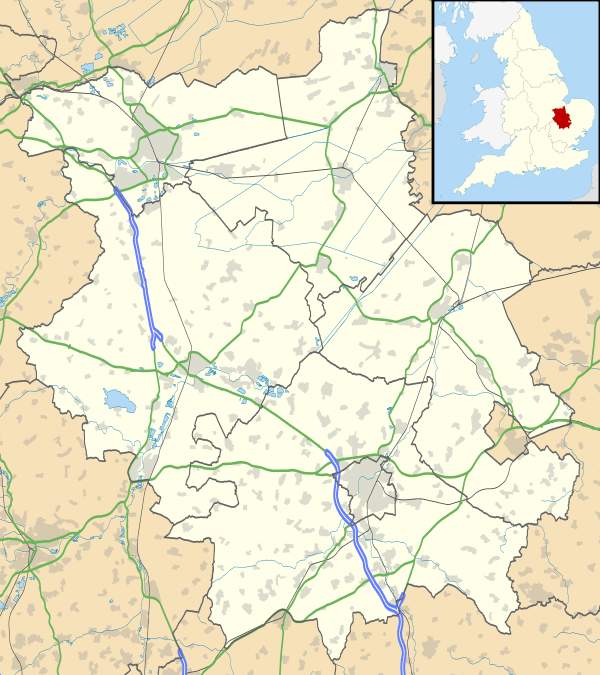
Brampton, Cambridgeshire
| Brampton | |
 Brampton |
|
| Population | 4,862 (2011) |
|---|---|
| OS grid reference | TL205705 |
| Civil parish | Brampton |
| District | Huntingdonshire |
| Shire county | Cambridgeshire |
| Region | East |
| Country | England |
| Sovereign state | United Kingdom |
| Post town | HUNTINGDON |
| Postcode district | PE28 |
| Dialling code | 01480 |
| Police | Cambridgeshire |
| Fire | Cambridgeshire |
| Ambulance | East of England |
| EU Parliament | East of England |
| UK Parliament | Huntingdon |
|
|
Coordinates: 52°19′10″N 0°14′01″W / 52.319384°N 0.233529°W
Brampton is a village and civil parish in Cambridgeshire, England,[1] about 2 miles (3 km) south-west of Huntingdon. It lies within Huntingdonshire, a non-metropolitan district of Cambridgeshire and a historic county of England. According to the 2001 UK census, Brampton had a population of 5,030, but this fell slightly to 4,862 in the 2011 UK census.[2]
History
Historically, Brampton was variously known as Brantune (11th century), Brantone or Bramptone (12th–13th centuries), and Brauntone or Brampton (13th century). Scattered human remains dating back 1600–2000 years have been found in one or more gardens of houses near the local primary school. The exact origin of these has yet to be determined.
In the Domesday Book survey of 1086, Brampton was listed as Brantune in the Hundred of Leightonstone in Huntingdonshire[3] It had two manors, yielding aggregate rents to their lords of the manors in 1066 of £20, which had increased to £21.5 by 1086.[4] Domesday recorded a total of 42 households, which gives a population estimate of 125–200.[4][5] The area expressed in hides (variously defined as the area a team of eight oxen could plough in a season – 120 acres (49 hectares), thought to support a household – or as the area that could be assessed as £1 for tax purposes. Brampton was put down for 18 ploughlands in 1086.,[4] plus 100 acres (40 hectares) of meadows, 194 acres (79 hectares) of woodland, and two water mills.[4] The tax assessment was expressed in geld or danegeld and by 1130 it was being collected annually at rates varying between two and six shillings in the pound. For the Brampton manors the tax liability was 16.3 geld in 1068.[4]
The church and its incumbent priest antedate Domesday. The Church of St Mary Magdalene (earlier St Mary the Virgin) today consists of a chancel with a north vestry, nave, north aisle, south aisle, west tower, and north and south porches. The existence of the church is mentioned in Domesday, but very few features of today's church date from earlier than the 14th century.[6]
Brampton has associations with the diarist Samuel Pepys.[7] Legend has it that his fortune is buried somewhere in the village.[8] Brampton was the home of his uncle, Robert Pepys, elder brother of the diarist's father, whose house still stands. Samuel Pepys is known to have stayed there and at the Black Bull Inn in the village.
Government
As a civil parish, Brampton has an elected parish council. It has 15 members and normally meets on the third Wednesday of every month.[9][10] Its second tier of local government is Huntingdonshire District Council which is based in Huntingdon. Brampton is a district ward with two district councillors.[11][12]
Brampton's highest tier of local government is Cambridgeshire County Council, based in Cambridge. (Brampton belonged to the historic and administrative county of Huntingdonshire until 1965, thereafter to the new administrative county of Huntingdon and Peterborough, and since 1974 lies in the county of Cambridgeshire.) Brampton forms part of the electoral division of Brampton and Kimbolton, represented by a single county councillor.[11][13]
At Westminster, Brampton is in the parliamentary constituency of Huntingdon, represented in the House of Commons by Jonathan Djanogly (Conservative) since 2001. The previous member was John Major (Conservative, 1983–2001). The village is part of the East of England constituency, which elects seven MEPs using the d'Hondt method of party-list proportional representation.
Geography
At one time the higher part of Brampton parish was forested, but it now has less than 300 acres (1.2 km2) of woodland. (See Brampton Wood.) It is generally low-lying, mostly about 33 feet (10 m) above sea level, although the ground rises to 164 feet (50 m) towards the south-west boundary.
Demography
Population
The earliest census data, from 1801, gives the lowest population figure for Brampton: 1801. The highest 19th-century count, 1281, came in 1851.[2]
Since 1901, a census has been taken every ten years with the exception of 1941 (due to the Second World War).
| Parish |
1911 |
1921 |
1931 |
1951 |
1961 |
1971 |
1981 |
1991 |
2001 |
2011 |
|---|---|---|---|---|---|---|---|---|---|---|
| Brampton | 895 | 930 | 1031 | 1718 | 3068 | 4494 | 4363 | 4508 | 5030 | 4862 |
All population census figures from report Historic Census figures Cambridgeshire to 2011 by Cambridgeshire Insight.[2]
In 2011, the parish covered an area of 3,558 acres (1,440 hectares).[2] The density of population was therefore 874.6 persons per square mile (337.6 per square km).
Amenities
The village has retail, medical, dental and veterinary services. There are two horticultural nurseries.[14] Brampton Garden Centre, run by East Anglian company Frosts, also has a restaurant which recently won an award in 2008 for the best Garden Centre Restaurant in the North Thames area.[15]
Four establishments offer bar drinking service: The Dragoon, The Old Mill, "The Bull" and the Montaz Tandoori restaurant[14] (formerly The Harrier, named in honour of the RAF base located in the village). Drinks are also served to members at The Institute and the Bowls Club. The Grange Hotel, Brampton, once a private residence, closed down in 2013 for conversion into flats. A large 18th-century brick building, it had been requisitioned in the Second World War for the American Eighth Air Force.[16][17] RAF Brampton closed in 2013 and its land was sold for development – plans have been submitted for up to 402 new houses.
Brampton is on a regular bus route to St Neots, Hinchingbrooke, Huntingdon and Tesco – routes 65 and 66, are operated by Stagecoach in Huntingdonshire. The nearest rail services are from Huntingdon railway station, 1.6 miles (2.6 km) to the east.
Brampton Park is an 18-hole golf course featuring the par-3 4th, a signature hole with a green almost completely surrounded by water, often referred to as England's hardest par-3. The village has a large skate park on the Memorial Playing Fields, alongside the Memorial Hall, and in 2013 a Multi Users Games Area (MUGA) was opened. There are also pitches for Association Football and cricket. Huntingdon Racecourse lies within the parish.
Education
Brampton has one recently merged (September 2007) school named Brampton Village Primary School.[18] It was classified as good according to all the main criteria at the most recent Ofsted inspection in March 2012.[19] Previously there were two separate schools on the same site: an infants school and a junior school.
Religious sites
The Anglican church of St Mary Magdalene shares its clergy with the parishes of Ellington and Grafham. There is a Methodist church belonging to the St Neots and Huntingdon circuit on The Green.
Notable person
- Geoff Capes, the Commonwealth shot-put champion and two times winner of the title of World's Strongest Man, served as a police officer in Brampton in the 1970s.[20]
References
- ↑ Ordnance Survey: Landranger map sheet 153 Bedford & Huntingdon (St Neots & Biggleswade) (Map). Ordnance Survey. 2013. ISBN 9780319231722.
- 1 2 3 4 "Historic Census figures Cambridgeshire to 2011" (xlsx – download). www.cambridgeshireinsight.org.uk. Cambridgeshire Insight. Retrieved 12 February 2016.
- ↑ Dr Ann Williams, Professor G.H. Martin, eds. (1992). Domesday Book: A Complete Translation. London: Penguin Books. p. 1318. ISBN 0-141-00523-8.
- 1 2 3 4 5 Professor J.J.N. Palmer, University of Hull. "Open Domesday: Place – Brampton". www.opendomesday.org. Anna Powell-Smith. Retrieved 25 February 2016.
- ↑ Goose, Nigel; Hinde, Andrew. "Estimating Local Population Sizes" (PDF). Retrieved 23 February 2016.
- ↑ Statement of significance Retrieved 14 October 2015.
- ↑ http://www.pepys.info/bramho.html
- ↑ http://www.pepys.info/1667/1667oct.html#digupmygold
- ↑ "Brampton Parish Council: Councillors". Brampton Parish Council. Retrieved 5 February 2016.
- ↑ "Brampton Parish Council:Calendar" (pdf). Brampton Parish Council. Brampton Parish Council. Retrieved 5 February 2016.
- 1 2 "Ordnance Survey Election Maps". www.ordnancesurvey.co.uk. Ordnance Survey. Retrieved 4 February 2016.
- ↑ "Huntingdonshire District Council: Councillors". www.huntsdc.gov.uk. Huntingdonshire District Council. Retrieved 4 February 2016.
- ↑ "Cambridgeshire County Council: Councillors" (pdf). www.cambridgeshire.gov.uk. Cambridgeshire County Council. Retrieved 4 February 2016.
- 1 2 Parish site. Retrieved 14 October 2015.
- ↑ http://www.diyweek.net/news/news.asp?id=11483
- ↑ http://www.8thafhs.org/combat1943.htm
- ↑ http://www.ibiblio.org/hyperwar/AAF/I/AAF-I-17.html
- ↑ School site. Retrieved 14 October 2015.
- ↑ Ofsted report.Retrieved 14 October 2015.
- ↑ "A Long Shot Right on Target". CNN. 26 January 1976. Retrieved 26 April 2010.
External links
| Wikimedia Commons has media related to Brampton, Cambridgeshire. |
- Local bus times
- Village Friends on Facebook
- Establishment of the Eighth Air Force in the United Kingdom
- Eighth Air Force Historical Society, January 1943 Through December 1943