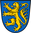
Braunschweig (district)
| Landkreis Braunschweig | ||
|---|---|---|
| District | ||
| ||
| Country |
| |
| State | Lower Saxony | |
| Disbanded | 28 February 1974 | |
| Capital | Braunschweig | |
| Area | ||
| • Total | 462,44 km2 (17,855 sq mi) | |
| Population (1969) | ||
| • Total | 94,100[1] | |
| Time zone | CET (UTC+1) | |
| • Summer (DST) | CEST (UTC+2) | |
| Vehicle registration | BS | |
Braunschweig or Landkreis Braunschweig was a district in Lower Saxony, Germany. The administrative centre of the district was the independent city of Braunschweig, which, however, was not part of the district itself.
The district was disbanded on 28 February 1974, as part of a district reform in Lower Saxony.[2] The main part of the district was incorporated into the city of Braunschweig, while smaller parts were merged into the districts of Helmstedt, Peine, and Wolfenbüttel.
At the time of its disestablishment, the district consisted of:
- the municipalities of Abbenrode, Alvesse, Beienrode, Bettmar, Bevenrode, Bienrode, Bodenstedt, Bortfeld, Broitzem, Cremlingen, Denstorf, Destedt, Dibbesdorf, Duttenstedt, Erkerode, Essehof, Essenrode, Essinghausen, Flechtorf, Fürstenau, Gardessen, Groß-Brunsrode, Groß-Gleidingen, Harvesse, Hemkenrode, Hötzum, Hondelage, Hordorf, Klein-Brunsrode, Klein-Gleidingen, Klein-Schöppenstedt, Köchingen, Lamme, Lehre, Liedingen, Lucklum, Mascherode, Meerdorf, Neubrück, Niedersickte, Obersickte, Rautheim, Rüningen, Schandelah, Schapen, Schulenrode, Sierße, Sonnenberg, Sophiental, Stöckheim bei Braunschweig, Thune, Timmerlah, Vallstedt, Vechelade, Vechelde, Veltheim (Ohe), Völkenrode, Volkmarode, Waggum, Wahle, Watenbüttel, Weddel, Wedtlenstedt, Wendeburg, Wenden, Wendezelle, Wendhausen, Wierthe, and Zweidorf
- the unincorporated areas of Beienrode, Buchhorst, Essehof I, Essehof II, Essehof III, Meerdorfer Holz, Querum, Sophiental I, Sophiental II, and Wendhausen.
The exclave of Thedinghausen had already been incorporated into the district of Verden in 1972.[3]
References
- ↑ Stadt und Landkreis Braunschweig (in German), accessed 24 September 2013.
- ↑ Stadtchronik Braunschweig: 1974 (in German), accessed 24 September 2013.
- ↑ Die Samtgemeinde (in German), accessed 24 September 2013.
Coordinates: 52°16′12″N 10°31′12″E / 52.27000°N 10.52000°E
This article is issued from Wikipedia - version of the 12/8/2015. The text is available under the Creative Commons Attribution/Share Alike but additional terms may apply for the media files.
