Braydon
| Braydon | |
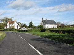 Former church, Braydon |
|
 Braydon |
|
| Population | 43 (in 2011)[1] |
|---|---|
| OS grid reference | SU056882 |
| Unitary authority | Wiltshire |
| Ceremonial county | Wiltshire |
| Region | South West |
| Country | England |
| Sovereign state | United Kingdom |
| Post town | Swindon |
| Postcode district | SN5 |
| Dialling code | 01666 |
| Police | Wiltshire |
| Fire | Dorset and Wiltshire |
| Ambulance | South Western |
| EU Parliament | South West England |
| UK Parliament | North Wiltshire |
Coordinates: 51°35′35″N 1°55′16″W / 51.593°N 1.921°W
Braydon is a civil parish in north Wiltshire, England, about 6 miles (10 km) northwest of Swindon. A sparsely-populated farming area with no centres of settlement, it is best known for sharing its name with Braydon Forest. The population of the parish was 48 in 1881 and was little changed in 2011, at 43.[1]
The River Key, a tributary of the Thames, rises in the parish. Ravensroost Wood, in the far west of the parish, is a nature reserve managed by Wiltshire Wildlife Trust.
History
Evidence has been found of prehistoric people, including a Neolithic axehead and a possible Palaeolithic flint tool.[2]
In 903, the rebel Saxon Æthelwold of Wessex and the Viking raiding-army from East Anglia raided Braydon and the surrounding area.[3]
In the Middle Ages, Braydon was a tithing of Purton and belonged to the Duchy of Lancaster, giving rise to the name of Duchy Wood, and passed to the Crown with the rest of the Duchy.[4] Red Lodge was a royal hunting lodge until the land was developed in the 17th century. In 1826, the Crown exchanged Braydon for other land and it thus came into the ownership of the 3rd Earl of Clarendon, who had previously leased it. In 1829 the estate was sold to Joseph Neeld of Grittleton, at which time it consisted of 1,357 acres (5.49 km2) divided into several farms, called Battle Lake, Cock's Hill, Duchy, Maple Sale, Park Gate with Roebuck, Pound House, Raven's Roost, Red Lodge, and White Lodge. In 1901 the Neeld estate was broken up, and by 1910 about half of Braydon belonged to Mr J. E. Ward, whose granddaughter Elizabeth Ward owned Red Lodge, Pound and Coxhill farms in 2007.[5]
A small school was built in 1858 and became a National School in 1876. The school closed in 1933 owing to falling pupil numbers.[6]
In 1866, Braydon became a civil parish separate from Purton.[4]
In 1887 Braydon was said to be "occupied chiefly by squatters, who led a wretched life".[7]
Religious sites
A small Anglican church was built in 1868, and later moved to a site near the Ashton Keynes road (now the B4696). The church closed in the 1970s and became a private house.[8]
Braydon Methodist chapel was built in 1889, just over the southwest boundary of the parish. It is a "tin tabernacle" constructed with corrugated iron, and is still in use as of 2016.[9][10]
Braydon Forest
In the year 688, Cædwalla, king of the West Saxons, granted Abbot Aldhelm of Malmesbury Abbey thirty hides on the eastern side of Braydon Wood (de orientali parte silve Bradon).[11]
At its greatest extent, Braydon Forest covered about a third of the area of Wiltshire, but over the centuries most of it was slowly cleared.[12]
Governance
With its tiny population, Braydon is considered too small to merit a parish council and has instead a parish meeting.[4] Most significant local government functions are now carried out by the Wiltshire Council unitary authority. At the parliamentary level, the parish is part of the North Wiltshire county constituency and the current member of parliament is James Gray (Conservative).
References
- 1 2 "Wiltshire Community History - Census". Wiltshire Council. Retrieved 17 February 2016.
- ↑ http://history.wiltshire.gov.uk/smr/smr_search.php?parish_in=Braydon
- ↑ Swanton, M. 2000 The Anglo-Saxon Chronicles (London: Phoenix Press)
- 1 2 3 "Braydon". Wiltshire Community History. Wiltshire Council. Retrieved 17 February 2016.
- ↑ "Braydon" (PDf). englandspastforeveryone.org.uk.
- ↑ "National School, Braydon". Wiltshire Community History. Wiltshire Council. Retrieved 17 February 2016.
- ↑ Wiltshire Archaeological Magazine, XXIII, p. 164
- ↑ "Anglican church, Braydon". Wiltshire Community History. Wiltshire Council. Retrieved 17 February 2016.
- ↑ "Upper Thames circuit: Braydon". The Methodist Church. Retrieved 17 February 2016.
- ↑ "Tin chapel grows in popularity". BBC Wiltshire. 1 June 2010. Retrieved 17 February 2016.
- ↑ S. E. Kelly (ed.) (2005). Charters of Malmesbury Abbey, Anglo-Saxon Charters 11. Oxford University Press for the British Academy. Oxford: trin.cam.ac.uk. p. S 234.
- ↑ "Braydon: a study of settlement in a parish-edge forest", Paul Pattison, David Field, Stewart Ainsworth, Patterns of the past: essays in landscape archaeology for Christopher Taylor (1999)
External links
![]() Media related to Braydon at Wikimedia Commons
Media related to Braydon at Wikimedia Commons