Bridges over the Brisbane River
The Brisbane River, running through Brisbane, Queensland, Australia, is crossed by fifteen major bridges, from the Sir Leo Hielscher Bridges downstream to the Centenary upstream. The river meanders through an urban area that comprises 1.8 million people.
There are two smaller crossings in the west of Brisbane City in the suburb of Mount Crosby: the Mount Crosby Weir, and Colleges Crossing (which straddles the boundary between Brisbane and Ipswich).
Planning
A bridge downstream of the Victoria Bridge was part of a larger plan, devised by Professor Roger Hawken of the University of Queensland in the 1920s, for a series of bridges over the Brisbane River to alleviate congestion on Victoria Bridge and to divert traffic away from the Brisbane central business district. The William Jolly Bridge was the first of the Hawken Plan bridges to be constructed. Lack of funds precluded the construction of the downstream bridge at that time. Initially plans called for a transporter bridge further downstream near New Farm.
In 1926 Kangaroo Point was recommended by the Brisbane City Council's Cross River Commission.[1] Subsequently the bridge was constructed as a public works program during the Great Depression. The cost was to be no more than ₤1.6 million.[2]
Major bridges
| # | Name | Usage | Description | Suburbs | Photo |
|---|---|---|---|---|---|
| 1 | Sir Leo Hielscher (two bridges) — original bridge formerly known as the Gateway Bridge | vehicles, cyclists & pedestrians | Original bridge opened January 1986. Duplicate bridge opened May 2010. Concrete box girder design. 260 metre (853 ft) main span.[3] |
Murarrie, Eagle Farm | |
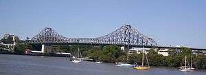
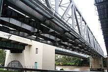
| 2 | Story | vehicles & pedestrians | Opened July 1940. Steel truss design. 777 metres (2,549 ft) long with a 282-metre (925 ft) main span.[4] |
Kangaroo Point, Brisbane City, Fortitude Valley | |
| 3 | Captain Cook | vehicles | Opened 1972. Concrete box girder design. 555 metres (1,821 ft) long with 183 metre (600 ft) main span.[5] |
South Brisbane, Kangaroo Point, Brisbane City | |
| 4 | Goodwill | pedestrians & cyclists | Opened October 2001. 450 metres (1,476 ft) long with 102 metre (335 ft) main span.[6] |
South Brisbane, Brisbane City | |
| 5 | Victoria | vehicles, cyclists & pedestrians | Opened 1969. Replaced its namesake. 146.3 metre (480 ft) main span.[7] |
South Brisbane, Brisbane City | |
| 6 | Kurilpa | pedestrians & cyclists | Opened October 2009. 'Tensegrity' design. 425m long pathway[8] |
South Brisbane, Brisbane City | |
| 7 | William Jolly — also known as Grey Street Bridge | vehicles & pedestrians | Opened March 1932. Concrete arch design. 498 metres (1,634 ft) long with a 73-metre (240 ft) main span.[9] |
South Brisbane, Brisbane City | |
| 8 | Merivale | rail | Opened November 1978. Tied steel arch design. Main span 132 metre (433 ft).[10] |
South Brisbane, Brisbane City | |
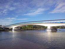
| 9 | Go Between — formerly known as Hale Street Link. | vehicles, cyclists & pedestrians | Opened 5 July 2010. Concrete box girder balanced cantilever design.[11] |
South Brisbane, Milton, Brisbane City | |
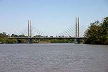
| 10 | Eleanor Schonell — formerly known as Green Bridge. | buses, cyclists & pedestrians | Opened December 2006. Cable-stayed design. 390 metres (1,280 ft) long.[12] |
Dutton Park, St Lucia | |
| 11 | Jack Pesch | cyclists & pedestrians | Opened October 1998. Steel cable-stay design.[13] |
Chelmer, Indooroopilly | |
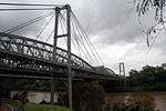
| 12 | Albert | rail | Opened 1895. Steel truss design. Replaced its namesake. 208 metres (682 ft) long with two spans each 103.7 metres (340 ft).[14] |
Chelmer, Indooroopilly | |
| 13 | Indooroopilly Railway | rail | Opened 1957. Steel truss design. 208.5 metres (684 ft) long with two equal spans.[15] |
Chelmer, Indooroopilly | |
| 14 | Walter Taylor | vehicles & pedestrians | Opened February 1936. Suspension design. Main span 183 metres (600 ft). The bridge's towers are occupied.[16] |
Chelmer, Indooroopilly | |
| 15 | Centenary | vehicles, cyclists & pedestrians | Opened in 1964. Concrete girder[17] |
Jindalee, Kenmore, Fig Tree Pocket |
Map
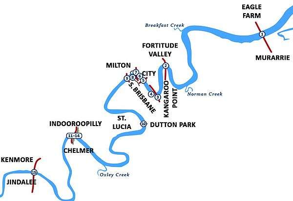
Legend
Future bridges
In 2007 the Smart State Council announced plans for a series of new green mode bridges for Brisbane. New bridges include;
- a connection from Margaret Street near the Stock Exchange in the City to Thornton Street, Kangaroo Point.
- from Cairns Street Kangaroo Point a new bridge will connect to the end of the floating riverwalk at Merthyr Road, New Farm.
- and from Merthyr Road, Teneriffe a new bridge will connect to Hardcaste Park, Hawthorne (near Lindsay Street).
These new bridges will create a greenway corridor over 5 green bridges from Morningside, through Hawthorne, Teneriffe, New Farm, Kangaroo Point, City, Northbank, South Bank, Dutton Park and Boggo Road to the University of Queensland.[18]
Crossings between the Centenary Bridge and Wivenhoe Dam
In addition to the existing bridges between Centenary Bridge and Wivenhoe Dam a number of others have been proposed.
The Goodna Bypass is designed to relieve congestion on the Ipswich Motorway and will have four new bridges over the river (but no access to or from the north-western suburbs). Land acquisitions were underway in 2010 to create the future transport corridor.[19] As of 2010, there is no date or funding provided to commence the construction of the Goodna Bypass.
The Western Bypass would have included a crossing of the river but has been cancelled.[20]
The existing crossings on this section of the river are listed below[21] (note: coordinates are derived from Google Earth).
| Name of crossing and/or road | Coordinates | Description and/or purpose | Photo |
|---|---|---|---|
| Moggill Ferry | 27°35′41″S 152°51′22″E / 27.59472°S 152.85611°E | Links Riverview to Moggill | 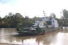 Moggill ferry, 2008 |
| Mount Crosby Road at Colleges Crossing | 27°33′25″S 152°48′15″E / 27.55694°S 152.80417°E | Links North Tivoli to Mount Crosby | College's Crossing, 2012 |
| Allawah Road across Mount Crosby Weir | 27°32′14″S 152°43′47″E / 27.53722°S 152.72972°E | Adjacent to Mount Crosby Pumping Station | 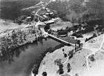 Bridge at the Mount Crosby Pumping Station, circa 1950 |
| Kholo Bridge, Kholo Road | 27°33′54.10″S 152°44′51.61″E / 27.5650278°S 152.7476694°E | Links North Ipswich to Kholo |  Pipeline being laid beside the Kholo Bridge, 1922 |
| McMullen Road (ford, no longer used) | Links Borallon to farms at Lake Manchester | ||
| Summervilles Road (Burtons Bridge) | 27°29′58″S 152°41′22″E / 27.49944°S 152.68944°E | Links Borallon to farms at Lake Manchester, near Lake Manchester Dam | 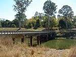 Summerville Road East crossing, 2014 |
| Banks Creek Road (Savages Crossing) | 27°26′37″S 152°40′13″E / 27.44361°S 152.67028°E | Links Fernvale to farms at Banks Creek | 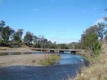 Savages Crossing, 2014 |
| Brisbane Valley Highway | 27°25′51″S 152°38′22″E / 27.43083°S 152.63944°E | Between Fernvale and Wivenhoe Dam, taking the highway east of the river | 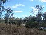 Brisbane Valley Highway crossing, 2014 |
| Wivenhoe Pocket Road (Twin Bridges) | 27°26′13″S 152°38′00″E / 27.43694°S 152.63333°E | Links Fernvale to farms in Wivenhoe Pocket, crossing the river via an island | 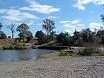 Wivenhoe Pocket Road crossing, 2014 |
| Brisbane Valley Highway across Wivenhoe Dam | 27°23′40″S 152°36′33″E / 27.39444°S 152.60917°E | The highway runs on top of the dam wall for 2.3 kilometres |  Dam wall and main gates |
Crossings from Lake Wivenhoe to Moore


When Lake Wivenhoe is full the waters extend many kilometres up the river.[21] The first crossing upstream from the lake is a high level bridge built in conjunction with the dam to raise the Esk Kilcoy Road well above the maximum level of the lake. Several minor crossings of this section of the river shown on maps are omitted from the list below. The omitted crossings belong to one of the following groups:
- Former low level crossings now covered (most of the time) by the waters of Lake Wivenhoe.
- Public or private roads that provide access to farms on the eastern side of the river.
- Private roads or tracks that link parts of farms that are astride the river.
The more significant crossings from Lake Wivenhoe to Moore are listed below.
| Name of crossing and/or road | Coordinates | Description and/or purpose | Photo |
|---|---|---|---|
| Esk Kilcoy Road | 27°08′18″S 152°30′36″E / 27.13833°S 152.51000°E | Links Esk to Kilcoy via Somerset Dam | |
| Gregors Creek Road | 26°59′14″S 152°23′54″E / 26.98722°S 152.39833°E | Links Brisbane Valley Highway to farms at Gregors Creek and provides an alternate route to Kilcoy | |
| D'Aguilar Highway | 26°56′39″S 152°21′33″E / 26.94417°S 152.35917°E | Links Brisbane Valley Highway to Kilcoy |
Upstream from Moore
Linville Road follows the river from Moore through Linville to the Mount Stanley State Forest.[21] It crosses the river 12 times between Linville and its end, where it splits into Western Branch Road and Eastern Branch Road. Western Branch Road follows the west branch of the river to its source in Elgin Vale State Forest, north-west of Mount Stanley, crossing it 28 times. Eastern Branch Road follows the east branch most of the way to its source south-east of Mount Stanley, crossing it about 20 times before it ends.
See also
For information about tunnels which cross the Brisbane River, please check the Brisbane River page.
References
- ↑ Gregory, Helen (2007). Brisbane Then and Now. Wingfield, South Australia: Salamander Books. p. 92. ISBN 978-1-74173-011-1.
- ↑ Hacker, D. R. (1999). Petries Bight: a Slice of Brisbane History. Bowen Hills, Queensland: Queensland Women's Historical Association Inc. pp. 45—46. ISBN 0-9590271-8-1.
- ↑ Structurae: Gateway Bridge (1986), retrieved 2008-11-26
- ↑ Structurae: Story Bridge (1940), retrieved 2008-11-26
- ↑ Structurae: Captain Cook Bridge (1972), retrieved 2008-11-26
- ↑ Structurae: Goodwill Pedestrian Bridge, retrieved 2008-11-26
- ↑ Structurae: Victoria Bridge (1969), retrieved 2008-11-26
- ↑ Department of Public Works: Kurilpa Bridge, archived from the original on 2009-05-04, retrieved 2009-03-16
- ↑ Structurae: William Jolly Bridge (1932), retrieved 2008-11-26
- ↑ Structurae: Merivale Bridge (1978), retrieved 2008-11-26
- ↑ Hale Street Link, retrieved 2010-06-20
- ↑ Structurae: Eleanor Schonell Bridge (2006), retrieved 2008-11-26
- ↑ Structurae: Jack Pesch Bridge (1998), retrieved 2008-11-26
- ↑ Structurae: Albert Bridge (1893), retrieved 2008-11-26
- ↑ Queensland State Archives Series ID 18136, Indooroopilly Railway Bridge Plans, retrieved 2008-11-26
- ↑ Structurae: Walter Taylor Bridge (1936), retrieved 2008-11-26
- ↑ Structurae: Centenary Bridge, retrieved 2008-11-26
- ↑ Ministerial Media Statements, July 15, 2007, retrieved 2008-11-26
- ↑ Nation Building Program National Projects Goodna Bypass Land Acquisition (accessed 19 September)
- ↑ "Western Brisbane Transport Network Strategy". Queensland Government. 20 October 2009. Retrieved 10 January 2010.
- 1 2 3 "Google maps Australia". Google. Retrieved 9 September 2010.
External links
- Historical Brisbane River Map - shows the positions of Brisbane bridges on the river
- Images of Brisbane bridges - a slideshow of historical images of Brisbane bridges from Picture Queensland, State Library of Queensland
