Brown Mountain (Klamath County, Oregon)
| Brown Mountain | |
|---|---|
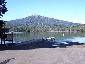 Brown Mountain from across Lake of the Woods | |
| Highest point | |
| Elevation | 7344+ ft (2238+ m) NAVD 88[1] |
| Prominence | 2,058 ft (627 m) [1] |
| Coordinates | 42°21′48″N 122°16′17″W / 42.36333°N 122.27139°WCoordinates: 42°21′48″N 122°16′17″W / 42.36333°N 122.27139°W [2] |
| Geography | |
 Brown Mountain Location in Oregon | |
| Location | Klamath / Jackson counties, Oregon, U.S. |
| Topo map | USGS Brown Mountain |
| Geology | |
| Mountain type | Shield volcano[3] |
| Volcanic arc | Cascade Volcanic Arc[3] |
| Last eruption | Over 12,000 years ago[3] |
| Climbing | |
| Easiest route | Scramble[4] |
Brown Mountain is a small cinder cone on top of a shield volcano located in Cascade Volcanic Arc in Klamath and Jackson counties, Oregon.[3] Most of the mountain, including its peak, is in western Klamath County, but its western flanks trail off into eastern Jackson County. It is 7,311 feet (2,228 m) above sea level, but is overshadowed by nearby 9,495-foot (2,894 m) Mount McLoughlin.[5]
Geology
Brown Mountain appears to be relatively young at first as its summit is unweathered and devoid of trees, however glacial valleys and a cirque near the summit prove that the mountain is actually twelve thousand to sixty thousand years old.[5] Around two thousand years ago,[6] a large lava flow consisting primarily of basaltic andesite covered 13 square miles (34 km2) of the north and western slopes with Aa-type lava over 250 feet (76 m) thick.[5][7][8] Over its lifetime, the mountain has erupted over 1.2 cubic miles (5.0 km3) of lava.[3]
Access and trails
Brown Mountain can be accessed via Oregon Route 140, which passes just north of the peak. It can also be accessed through the Pacific Crest Trail, and the 6.8-mile (10.9 km) Brown Mountain Trail.[6][9][10]
Flora and fauna
The area at the base of the mountain is covered with old growth forests.[10] The mountain is also home to animals such as Douglas squirrels and pikas. Toward the summit, the land is nearly devoid of vegetation.[5]
References
- 1 2 "Brown Mountain, Oregon". Peakbagger.com. Retrieved 2009-08-27.
- ↑ "Brown Mountain". Geographic Names Information System. United States Geological Survey. Retrieved 2008-11-22.
- 1 2 3 4 5 "Oregon Volcanoes - Brown Mountain Volcano". Deschutes & Ochoco National Forests - Crooked River National Grassland. United States Forest Service. 2006-11-23. Archived from the original on 2010-11-09. Retrieved 2008-09-08.
- ↑ Wood, Charles A.; Jűrgen Kienle (1993). Volcanoes of North America. Cambridge University Press. p. 199. ISBN 0-521-43811-X.
- 1 2 3 4 "Description: Brown Mountain, Oregon". United States Geological Survey. 2000-08-21. Archived from the original on 2008-07-04. Retrieved 2009-03-17.
- 1 2 Lee, Mary (2008-08-21). "Day-hiking the PCT". Mail Tribune. Retrieved 2009-03-17.
- ↑ Tittler, Andrew (1992). "A Geological History of Brown Mountain, Oregon" (PDF). Keck Symposium. 5 (5th Keck Symposiom Volume): 161–164. Retrieved 2009-03-18.
- ↑ Ostertag, George (2005). Camping Oregon (2nd ed.). Globe Pequot. p. 238. ISBN 978-0-7627-3643-0.
- ↑ Kettler, Bill (2007-07-08). "Brown Mountain Trail features lava flow". Mail Tribune. Retrieved 2009-03-18.
- 1 2 "Brown Mountain Trail #1005". Rogue River-Siskiyou National Forest. Retrieved 2016-05-05.
External links
- "Brown Mountain". SummitPost.org.