Bukit Indah Highway
| Bukit Indah Highway | |
|---|---|
 | |
| Route information | |
| Length: | 5 km (3 mi) |
| Major junctions | |
| North end: |
Bukit Indah-LINKEDUA Interchange (Pontian-Johor Bahru Parkway) |
|
(Pontian-Johor Bahru Parkway) | |
| South end: |
Bukit Indah (South) Interchange |
| Location | |
| Primary destinations: |
Bukit Indah Horizon Hills |
| Highway system | |
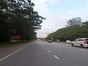
Bukit Indah Highway (Malay: Lebuhraya Bukit Indah) is a major highway in Johor Bahru District, Johor, Malaysia.
List of interchanges
| Km | Exit | Interchange | To | Remarks | |
|---|---|---|---|---|---|
| Bukit Indah-linkedua Interchange | Pontian-johor Bahru Parkway West East | Trumpet interchange | |||
Start/End of expressway PLUS Expressway border limit | |||||
| Bukit Indah Highway
| |||||
| Bukit Indah Persiaran Indah | Persiaran Indah West Taman Nusa Indah East Skudai Other Townships | Junctions | |||
| Bukit Indah 2 Persiaran Indah Utama | West Persiaran Indah Utama Taman Nusa Indah | Junctions | |||
| Jalan Persiaran Timur | West Jalan Persiaran Timur Horizon Hills | T-junctions | |||
| Bukit Indah Highway
| |||||
Lebuhraya Sultan Iskandar Start/End of Highway | |||||
| Horizon Hills Interchange | Lebuhraya Sultan Iskandar Southwest J4 Kota Iskandar Legoland Malaysia Northeast Danga Bay | Cloverleaf interchange | |||
See also
This article is issued from Wikipedia - version of the 7/18/2016. The text is available under the Creative Commons Attribution/Share Alike but additional terms may apply for the media files.