Mount Rantemario
| Rantemario | |
|---|---|
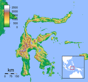 Rantemario Location on Sulawesi, Indonesia | |
| Highest point | |
| Elevation | 3,478 m (11,411 ft) [1] |
| Prominence |
3,478 m (11,411 ft) [2] Ranked 52nd |
| Isolation | 682 kilometres (424 mi) |
| Listing |
Ultra Ribu |
| Coordinates | 3°23′06″S 120°01′27″E / 3.38500°S 120.02417°ECoordinates: 3°23′06″S 120°01′27″E / 3.38500°S 120.02417°E [2] |
| Geography | |
| Location | Sulawesi, Indonesia |
Rantemario (Indonesian: Bulu Rantemario) is a mountain located in the province of South Sulawesi, Sulawesi, Indonesia. At 3,478 metres (11,411 ft), it is the highest mountain on the island,[1][2] although some sources state Mount Rantekombola as the highest point.
Locally, Rantemario is more commonly referred to as Latimojong. Latimojong can also designate the local mountain range and wilderness area of which Rantemario is the highest peak.
Rantemario can be climbed from the village of Kerangan and has eight designated "Pos" staging points, some of which are suitable for camping and have access to water. The nearest town is Baraka, 8 km off the main highway between Makassar and Tana Toraja.
See also
References
- 1 2 "Gunung Rantemario, Indonesia" Peakbagger.com. Retrieved 2011-11-20.
- 1 2 3 "Mountains of the Idonesian Archipelago" Listed as "Bulu Rantemario" on Peaklist.org. Retrieved 2011-11-20.
External links
This article is issued from Wikipedia - version of the 6/21/2016. The text is available under the Creative Commons Attribution/Share Alike but additional terms may apply for the media files.