Blosser Municipal Airport
Coordinates: 39°32′57″N 097°39′08″W / 39.54917°N 97.65222°W
| Blosser Municipal Airport | |||||||||||||||||||
|---|---|---|---|---|---|---|---|---|---|---|---|---|---|---|---|---|---|---|---|
| IATA: CNK – ICAO: KCNK – FAA LID: CNK | |||||||||||||||||||
| Summary | |||||||||||||||||||
| Airport type | Public | ||||||||||||||||||
| Owner | City of Concordia | ||||||||||||||||||
| Serves | Concordia, Kansas | ||||||||||||||||||
| Elevation AMSL | 1,486 ft / 453 m | ||||||||||||||||||
| Runways | |||||||||||||||||||
| |||||||||||||||||||
| Statistics (2007) | |||||||||||||||||||
| |||||||||||||||||||
Blosser Municipal Airport (IATA: CNK, ICAO: KCNK, FAA LID: CNK) is two miles south of Concordia, in Cloud County, Kansas.[1] The airport was named after Charles H. Blosser, a longtime Concordia resident, aviation enthusiast, and former city mayor. It is on land originally owned by the Blosser family.
Facilities
The airport covers 209 acres (85 ha); its one asphalt runway (17/35) is 3,600 x 60 ft (1,097 x 18 m). It has two turf runways: 12/30 is 2,205 x 265 ft (672 x 81 m) and 3/21 is 1,665 x 255 ft (507 x 78 m).[1]
In the year ending July 24, 2007 the airport had 14,550 aircraft operations, average 39 per day: 97% general aviation and 3% military. Nine aircraft were then based at the airport: eight single-engine and one ultralight.[1]
History
The airport's roots are in 1930, when Charlie Blosser laid the first dirt airstrip on his farm.[2] He later donated the land to the city for airport use.[3]
Image gallery
-
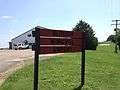
Airport welcome sign
-
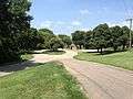
View of Airport Park
-
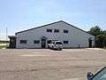
Main building
-
.JPG)
The Kansas Army National Guard Armory is in the airport complex
-
Video panorama of airport from ground level
.webm.jpg)
References
- 1 2 3 4 FAA Airport Master Record for CNK (Form 5010 PDF), effective 2007-12-20
- ↑ "Blosser Spends His 84 Years High in the Sky". Fort Scott Tribune. November 7, 1979. Retrieved August 7, 2013.
- ↑ "Tires Trouble Aerial Tradition". Warsaw, Indiana Times-Union. September 7, 1978. Retrieved August 7, 2013.
External links
- Resources for this airport:
- FAA airport information for CNK
- AirNav airport information for KCNK
- ASN accident history for CNK
- FlightAware airport information and live flight tracker
- NOAA/NWS latest weather observations
- SkyVector aeronautical chart, Terminal Procedures