Cabeza de Framontanos
| Cabeza de Framontanos | |
|---|---|
 Location | |
| Coordinates: 41°12′54″N 6°26′17″W / 41.21500°N 6.43806°W | |
| Country | Spain |
| Autonomous Community | Comunidad Autónoma de Castilla y León |
| Province | Salamanca |
| Founded | 13th century |
| Government | |
| • Mayor | María Consolación Salvador Salvador (PSOE) |
| Area | |
| • Land | 102.64 km2 (39.63 sq mi) |
| Elevation | 792 m (2,598 ft) |
| Population (2006) | |
| • Total | 122 |
| • Density | 1.189/km2 (3.08/sq mi) |
| Time zone | CET (UTC+1) |
| • Summer (DST) | CEST (UTC+2) |
| Postal code | 37174 |
| Area code(s) | 34 (Spain) + 923 (Salamanca) |
| Website | http://www.cabezadeframontanos.tk/ |
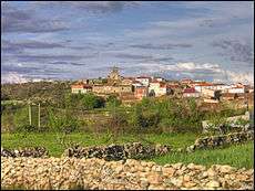
Cabeza de Framontanos is a village in the north-west of the province of Salamanca, western Spain, part of the autonomous community of Castile-Leon. From 1970 It belong to village Villarino de los Aires.
See also
List of municipalities in Salamanca
Coordinates: 41°12′54″N 6°26′17″W / 41.21500°N 6.43806°W
La Cabeza
This article is issued from Wikipedia - version of the 3/17/2013. The text is available under the Creative Commons Attribution/Share Alike but additional terms may apply for the media files.