California State Route 202
| ||||
|---|---|---|---|---|
|
Map of Kern County in south central California with SR 202 highlighted in red | ||||
| Route information | ||||
| Defined by Streets and Highways Code § 502 | ||||
| Maintained by Caltrans | ||||
| Length: | 10.53 mi[1] (16.95 km) | |||
| Major junctions | ||||
| West end: | California Correctional Institution | |||
| East end: |
| |||
| Location | ||||
| Counties: | Kern | |||
| Highway system | ||||
| ||||

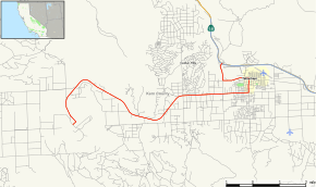
State Route 202 is a state highway in California, United States. It connects the California Correctional Institution to Route 58 in Tehachapi.
A portion of SR 202 is overlapped with SR 58 Bus. That portion follows the alignment of decommissioned U.S. Route 466.
Route description
The road begins with its western terminus at the California Correctional Institution along West Valley Boulevard, its name for part of the route. SR 202 then heads eastward through a farmland area before entering a suburb area of Tehachapi. The road then abruptly turns north toward SR 58 Bus where it heads concurrent with the business route through town to its eastern end at State Route 58 with an interchange.[2]
Major intersections
Except where prefixed with a letter, postmiles were measured on the road as it was in 1964, based on the alignment that existed at the time, and do not necessarily reflect current mileage. R reflects a realignment in the route since then, M indicates a second realignment, L refers an overlap due to a correction or change, and T indicates postmiles classified as temporary (for a full list of prefixes, see the list of postmile definitions).[3] Segments that remain unconstructed or have been relinquished to local control may be omitted. The entire route is in Kern County.
| Location | Postmile [3][4][5] | Destinations | Notes | ||
|---|---|---|---|---|---|
| | R1.48 | California Correctional Institution | West end of SR 202 | ||
| Tehachapi | R8.87 | Tucker Road, Valley Boulevard | |||
| 11.43 | West end of SR 58 Bus. overlap | ||||
| | 12.01 | Interchange; east end of SR 58 Bus. overlap; east end of SR 202 | |||
1.000 mi = 1.609 km; 1.000 km = 0.621 mi
| |||||
References
- ↑ January 1, 2006 California Log of Bridges on State Highways
- ↑ Microsoft; Nokia (2011-01-13). "California State Route 202" (Map). Bing Maps. Microsoft. Retrieved 2011-01-13.
- 1 2 California Department of Transportation. "State Truck Route List". Sacramento: California Department of Transportation. Archived from the original (XLS file) on June 30, 2015. Retrieved June 30, 2015.
- ↑ California Department of Transportation, Log of Bridges on State Highways, July 2007
- ↑ California Department of Transportation, All Traffic Volumes on CSHS, 2007