Caligata Lake Provincial Park
| Caligata Lake Provincial Park | |
|---|---|
|
IUCN category II (national park) | |
|
North Face of Raft Mountain near Caligata Lake | |
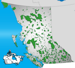 Location of Caligata Lake Provincial Park | |
| Location | British Columbia, Canada |
| Nearest city | Clearwater |
| Coordinates | 51°44′N 119°50′W / 51.733°N 119.833°WCoordinates: 51°44′N 119°50′W / 51.733°N 119.833°W |
| Area | 153 ha |
| Established | 1996 |
| Visitors | less than 100 (in 2010) |
| Governing body | BC Parks |
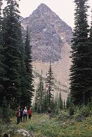
Caligata Lake Provincial Park is a provincial park in British Columbia, Canada, located northeast of Clearwater. The lake occupies a cirque below the north face of Raft Mountain. The park has no visitor facilities or services.
Access is by Spahats Creek Road off the Clearwater Valley Road (also called Wells Gray Park Road), then there is a short hike to the lake.
Cross-country hiking routes lead from Caligata Lake to the nearby Cirque of Tarns and Spahats Hill. A more rigorous hike ascends to the east ridge of Raft Mountain from where a skyline walk can go in either direction to Raft's multiple summits. [1]
The name comes from the Latin for the hoary marmot, marmota caligata.
References
- ↑ Neave, Roland (2015). Exploring Wells Gray Park, 6th edition. Wells Gray Tours, Kamloops, BC. ISBN 978-0-9681932-2-8.
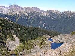
Cirque of Tarns above Caligata Lake. Trophy Mountain behind.
See also
This article is issued from Wikipedia - version of the 11/19/2016. The text is available under the Creative Commons Attribution/Share Alike but additional terms may apply for the media files.