Cape Morris Jesup
| Cape Morris Jesup | |
|---|---|
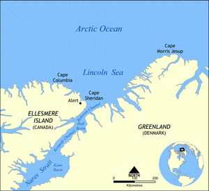
|
Map of Cape Morris Jesup and the Lincoln Sea. | |
| Location | Greenland |
| Offshore water bodies | Baffin Bay |
| Area | Arctic |
Cape Morris Jesup is the northernmost point of mainland Greenland at 83°37′39″N 32°39′52″W / 83.62750°N 32.66444°W and is 711.8 km (384 nm / 442 miles) from the geographic North Pole. Robert Peary reached the cape in 1900, believing it to be the northernmost point of land in the world, although it was later found to lie slightly to the south of the northernmost tip of Kaffeklubben Island.[1]
The cape is named after American philanthropist Morris Ketchum Jesup, who helped finance Peary's expeditions.
 Cape Morris Jesup amongst the extreme points of Greenland |
References
Coordinates: 83°37′39″N 32°39′52″W / 83.6275°N 32.664444°W
This article is issued from Wikipedia - version of the 4/2/2016. The text is available under the Creative Commons Attribution/Share Alike but additional terms may apply for the media files.