Castleman Trailway
Coordinates: 50°51′00″N 1°47′13″W / 50.850°N 1.787°W
| Castleman Trailway | |
|---|---|
|
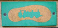
Waymark on the Castleman Trailway | |
| Length | 16 mi (26 km) |
| Location | Southern England |
| Designation | UK National Trail |
| Trailheads |
Ringwood, Hampshire Poole, Dorset. |
| Use | Hiking |

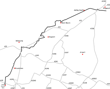
The Castleman Trailway is a footpath in Southern England. Portions of the trailway are also a cyclepath but the middle section from East Wimborne (close to The Old Thatch public house) to the River Allen bridge (just south of Wimborne) is not cyclable.
One trailhead is on Bickerley Road in Ringwood and the other trailhead is the car park at Upton Country Park. (From here, a cycle path runs along the sea front, all the way to Poole railway station). The entire Castleman Trailway path is waymarked.
The path passes through the villages of Ashley Heath, West Moors, Oakley, Broadstone and Upton, as well as Upton Heath and Upton Country Park.[1]
The trailway is part of the former Southampton and Dorchester Railway line which ran from Brockenhurst to Hamworthy Junction via Ringwood. It was known as "The Old Road". This circuitous route was promoted in the 19th century by the Wimborne solicitor Charles Castleman, and was chosen because of the need to run through populated areas at a time when Bournemouth was a small village. Many people called it "The Castleman Corkscrew" owing to the number of curves.
See also
References
Further reading
- Lucking, J. H. The Railways of Dorset
