Cauls Pond
Cauls Pond is a wetland in Anguilla, a British Overseas Territory in the Caribbean Sea. It is one of the territory’s Important Bird Areas (IBAs).
Description
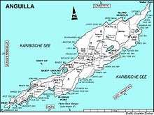
Cauls Pond is a rectangular brackish lagoon in the Sandy Hill district, near the south-east coast of the island. The second largest enclosed body of water in Anguilla, it lies beneath sea level and has a relatively large catchment. The substrate is mostly limestone with marl at its western end. It contains a small mudflat island. The vegetation around the edge of the pond consists of cacti and buttonwood mangroves, with other trees and shrubs growing behind them.[1]
Birds
The 43 ha IBA, consisting of the pond and its immediate surroundings, was identified as such by BirdLife International because it supports a breeding colony of least terns as well as populations of brown pelicans, laughing gulls, green-throated caribs, Caribbean elaenias, pearly-eyed thrashers and Lesser Antillean bullfinches.[1]
References
- 1 2 "Cauls Pond". Important Bird Areas factsheet. BirdLife International. 2014. Archived from the original on 2007-07-10. Retrieved 2014-04-06.
Coordinates: 18°13′23″N 63°01′19″W / 18.22306°N 63.02194°W