Canchal de la Ceja
| Canchal de la Ceja | |
|---|---|
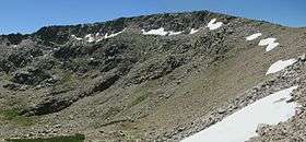 North face of the mountain | |
| Highest point | |
| Elevation | 2,428[1] m (7,966 ft) |
| Prominence | 1,151 m (3,776 ft) [1] |
| Coordinates | 40°18′16″N 05°43′44″W / 40.30444°N 5.72889°WCoordinates: 40°18′16″N 05°43′44″W / 40.30444°N 5.72889°W [1] |
| Naming | |
| Translation | Eyebrow scree (Spanish) |
| Geography | |
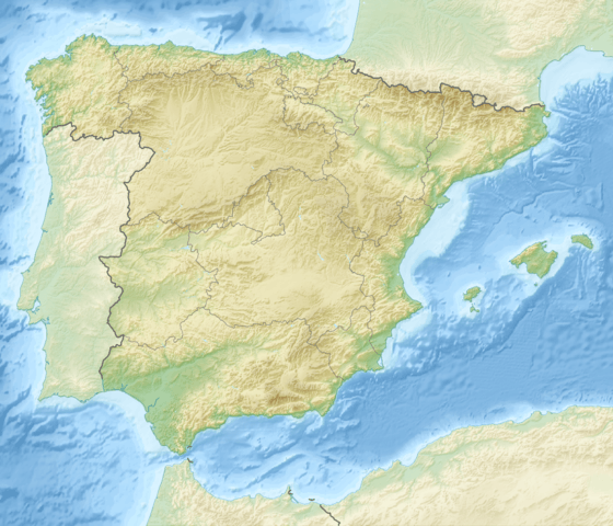 Canchal de la Ceja Spain | |
| Location |
Ávila (Castile and León) Salamanca (Castile and León) |
| Parent range | Sierra de Béjar (Sistema Central) |
| Climbing | |
| Easiest route | hike |
The Canchal de la Ceja is a 2.428 metres high mountain in Spain.
Etymology
Canchal means scree; the name Ceja (literally eyebrow) comes from the peculiar shape of the snowfield located below the summit on the North face of the mountain .
Geography
The mountain is located on the border between the provinces of Ávila and Salamanca, both belonging to Castile and León autonomous community. It's the highest peak of the mountain range called Sierra de Béjar and of Province of Salamanca.[2]
The lakes located around the mountain are the largest in the Sierra de Gredos area.[2]
Access to the summit
The shortest route to the summit starts from Plataforma del Travieso (1850 m,[3] around 10 km from Candelario) and takes a couple of hours hiking. The North face of the mountain offers some climbing routes.
See also
References
- 1 2 3 "Canchal de la Ceja, Spain". peakbagger.com. Retrieved October 24, 2015.
- 1 2 "Canchal de la Ceja". www.summitpost.org. Retrieved 2015-10-24.
- ↑ José Martínez Hernández (2001). Los techos de España (in Spanish). Madrid: Ediciones Desnivel. ISBN 9788495760067.
Bibliography
- R.M. Carrasco, J. De Pedraza (1995). "Morfología glaciar de las cimas en la Sierra de Gredos: monteras de hielo. En T. Aleixandre y A. Pérez-González (eds.), Reconstrucción de paleoambientes y cambios climáticos durante el Cuaternario" (PDF). Monografias del Centro de Ciencias Medioambientales (in Spanish). Centro de Ciencias Medioambientales (CSIC) (3): 226–238. Retrieved 2015-10-24.
External links
- (Spanish) Hiking route to Canchal de la Ceja
| Wikimedia Commons has media related to Canchal de la Ceja. |