Centennial Lake (Renfrew County)
| Centennial Lake | |
| Lake | |
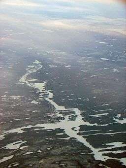 Centennial Lake, looking northwest towards Griffith | |
| Country | Canada |
|---|---|
| Province | Ontario |
| Region | Eastern Ontario |
| Counties | Renfrew, Frontenac |
| Townships | Greater Madawaska, North Frontenac |
| Part of | Saint Lawrence River drainage basin |
| Tributaries | |
| - Primary inflow | Madawaska River, Mackie Creek |
| Elevation | 250 m (820 ft) |
| Coordinates | 45°09′02″N 77°03′00″W / 45.15056°N 77.05000°WCoordinates: 45°09′02″N 77°03′00″W / 45.15056°N 77.05000°W |
| Primary outflow | Madawaska River |
| - coordinates | 45°10′24″N 77°00′51″W / 45.17333°N 77.01417°W |
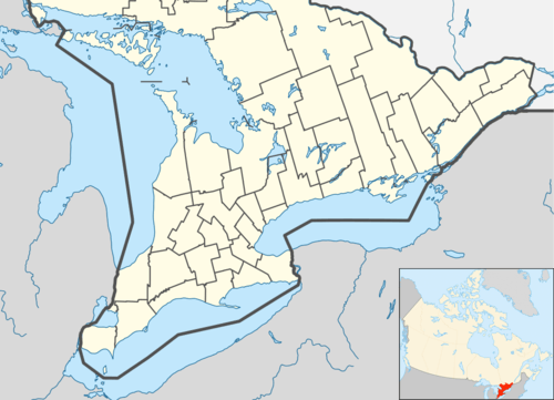 Location of Centennial Lake in southern Ontario
| |
Centennial Lake is a reservoir lake in the Township of Greater Madawaska, Renfrew County and the Township of North Frontenac, Frontenac County in Eastern Ontario, Canada.[1][2] It is on the Madawaska River and is part of the Saint Lawrence River drainage basin.
The lake is "L" shaped, with the downstroke oriented northwest/southeast, and the cross stroke oriented northeast/southwest. All but a tiny tip at the south end of the lake, the crux of the "L", is in the Township of Greater Madawaska, Renfrew County. The major inflow, at Camel Chute at the northwest, is the Madawaska River. A second primary inflow is Mackie Creek at the south, controlled by a weir dam. The major outflow is also the Madawaska River, which flows directly into Black Donald Lake at the northeast. The Madawaska River then flows via the Ottawa River to the Saint Lawrence River and thence to the Atlantic Ocean. Renfrew County Road 65 crosses the northwest arm of the lake over a long, low, concrete bridge.
History
Centennial Lake, and Black Donald Lake adjacent downstream, were created by the construction of the Mountain Chute Generating Station and dam and an associated embankment dam in 1965–1966.[3] Black Donald Lake subsumed the previous White Fish Lake and drowned the former mining community of Black Donald Mines, whose graphite mine by then had been exhausted. The reservoir took six months to fill and flooded 8,500 acres (3,440 ha).[4]
The lake is primarily used for recreation, tourism and cottages.[3]
Tributaries
Clockwise from the inflow of the Madawaska River
- Morrow Creek
- Mackie Creek
- Colton Creek
- Glenfield Creek
References
- ↑ "Centennial Lake". Geographical Names Data Base. Natural Resources Canada. Retrieved 2012-08-16.
- ↑ "Centennial Lake". Atlas of Canada. Natural Resources Canada. 2010-02-04. Retrieved 2012-08-16. Shows the area of the lake highlighted on a map.
- 1 2 Graham, Bill (2011-10-14). "A river flows by us". History: The Madawaska River. Township of Greater Madawaska. Retrieved 2012-08-16.
- ↑ Graham, Bill (2011-10-14). "Black Donald Mines". History: Black Donald. Township of Greater Madawaska. Retrieved 2012-08-16.
Other map sources:
- Map 10 (PDF) (Map). 1 : 700,000. Official road map of Ontario. Ministry of Transportation of Ontario. 2010-01-01. Retrieved 2012-03-10.
- Restructured municipalities - Ontario map #5 (Map). Restructuring Maps of Ontario. Ontario Ministry of Municipal Affairs and Housing. 2006. Retrieved 2012-08-16.