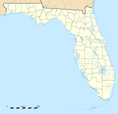
Central Instrumentation Facility
|
Central Instrumentation Facility | |
 | |
  | |
| Location | Brevard County, Florida, USA |
|---|---|
| Nearest city | Titusville, Florida |
| Coordinates | 28°31′27″N 80°39′22″W / 28.52417°N 80.65611°WCoordinates: 28°31′27″N 80°39′22″W / 28.52417°N 80.65611°W |
| Built | 1965 |
| Architect | Charles Luckman |
| Architectural style | International |
| Visitation | not open to the public (n/a) |
| MPS | John F. Kennedy Space Center MPS |
| NRHP Reference # | 99001635[1] |
| Added to NRHP | January 21, 2000 |
The Central Instrumentation Facility (CIF) is the core of instrumentation and data processing operations at NASA's John F. Kennedy Space Center, Florida supporting KSC's space launch responsibilities. It centralizes the handling of the center's data including offices, laboratories and test stations; and houses general instrumentation activities serving more than one launch complex.[2] The CIF also includes the Central Timing Facility, where a precision clock drives countdown clocks and other timing devices at KSC that require a high degree of accuracy.
The CIF also houses computers and other electronic equipment for reduction of telemetry data, analysis, and transmission to other NASA centers. The three-story structure of approximately 134,335 sq ft (12,480.1 m2) just west of the KSC Headquarters Building is one of the most distinctive buildings in the KSC Industrial Area with its rooftop array of various antennas.[3]
The CIF and the Headquarters Building, which are almost 50 years old and showing signs of their age, are to be demolished during the next several years and replaced by a headquarters building that will consolidate all shared services and most administrative functions across the Industrial Area.[4]
History

The CIF reflected the desire of Karl Sendler, KSC's first director of information systems, and his planners to centralize data handling. Although it was based on systems developed during Saturn I operations at Complexes 34 and 37, such experience was of limited value, because the distance from Launch Complex 39 to its Launch Control Center was more than 14 times as long. Planning and construction were coordinated with other NASA centers and with the Atlantic Missile Range. All metal in the building was grounded, and commercial power and the instrumentation power systems were grounded separately. Fluorescent lights, a source of electromagnetic interference, were not permitted.[5] Its architect, Charles Luckman, also designed other nearby buildings.
The CIF was added to the U.S. National Register of Historic Places on January 21, 2000.
CIF antenna site
A smaller building, later known as the CIF antenna site, was placed 1.5 miles (2.5 km) north of the Industrial Area, to be free of radio-frequency interference and have clear line-of-sight to the NASA launch complexes.[6]
References
- ↑ National Park Service (2010-07-09). "National Register Information System". National Register of Historic Places. National Park Service.
- ↑ Benson, Charles D.; Faherty, William Barnaby (1978), Moonport: A History of Apollo Launch Facilities and Operations, Scientific and Technical Information Office, National Aeronautics and Space Administration.
- ↑ Benson, Charles D.; Faherty, William Barnaby (1978), Moonport: A History of Apollo Launch Facilities and Operations, Scientific and Technical Information Office, National Aeronautics and Space Administration.
- ↑ "Kennedy Creating New Master Plan" NASA/KSC news release March 12, 2012
- ↑ Benson, Charles D.; Faherty, William Barnaby (1978), Moonport: A History of Apollo Launch Facilities and Operations, Scientific and Technical Information Office, National Aeronautics and Space Administration.
- ↑ Bidgood to CE Jacksonville, "Central Instrumentation Facility, MILA," 10 May 1963; B. Baker, memo for record, "Siting of the CIF," 22 Aug. 1963.44
![]() This article incorporates public domain material from websites or documents of the National Aeronautics and Space Administration.
This article incorporates public domain material from websites or documents of the National Aeronautics and Space Administration.