Chéméré
| Chéméré | ||
|---|---|---|
|
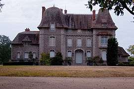
The Château du Bois-Rouaud, in Chéméré | ||
| ||
 Chéméré | ||
|
Location within Pays de la Loire region  Chéméré | ||
| Coordinates: 47°07′22″N 1°54′49″W / 47.1228°N 1.9136°WCoordinates: 47°07′22″N 1°54′49″W / 47.1228°N 1.9136°W | ||
| Country | France | |
| Region | Pays de la Loire | |
| Department | Loire-Atlantique | |
| Arrondissement | Saint-Nazaire | |
| Canton | Machecoul | |
| Intercommunality | Cœur Pays de Retz | |
| Government | ||
| • Mayor (2008–2014) | Jean-Paul Leray | |
| Area1 | 37.31 km2 (14.41 sq mi) | |
| Population (2006)2 | 2,021 | |
| • Density | 54/km2 (140/sq mi) | |
| Time zone | CET (UTC+1) | |
| • Summer (DST) | CEST (UTC+2) | |
| INSEE/Postal code | 44040 / 44680 | |
| Elevation | 2–60 m (6.6–196.9 ft) | |
| Website | http://www.chemere.fr/ | |
|
1 French Land Register data, which excludes lakes, ponds, glaciers > 1 km² (0.386 sq mi or 247 acres) and river estuaries. 2 Population without double counting: residents of multiple communes (e.g., students and military personnel) only counted once. | ||
_v2.svg.png)
Chéméré is a former commune in the Loire-Atlantique department in western France. On 1 January 2016, it was merged into the new commune of Chaumes-en-Retz.[1]
See also
| Wikimedia Commons has media related to Chéméré. |
References
- ↑ Arrêté préfectoral 14 December 2015
This article is issued from Wikipedia - version of the 3/15/2016. The text is available under the Creative Commons Attribution/Share Alike but additional terms may apply for the media files.