Chaah
Chaah is a mukim in Segamat District, Johor, Malaysia. It is the southernmost mukim in the district.
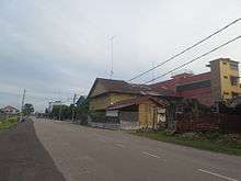
Chaah consists of Kampung and Taman Chaah Town, C-Block, Kampung Baru (residents are mostly Chinese), Kampung Java (Malay Kampung), Taman Damai Jaya I & II, Taman Sri Chaah, Taman Orkid, and is surrounded by oil palm plantations. Taman Chaah Baru (new Chaah garden) is 1 to 2 kilometres (0.6 to 1.2 mi) from Chaah Town.
The population consist of Malays, Chinese, Indians and Eurasians.
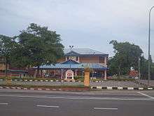
The highest education institute in Chaah is Sekolah Menengah Kebangsaan Chaah, (Chaah National Secondary School).
About 5 kilometres (3 mi) south of Chaah, there is a village named Desa Temu Jodoh. Established in the early 1970s, Desa Temu Jodoh got its name from the grand wedding ceremony among a large number of couples of early settlers. The number of couples married during the wedding ceremony was said to be the largest at that time in Malaysia.
There is a big Indian community in Chaah (about 4000 families). They all originate from the estates. The Indians are well grown people at Chaah. Many of them have own houses and lands, some others doing own business such as farming (bela lembu) ,contractors and so on.
Tamils or Indians mainly live in Taman Muhibbah, Taman Mesra, Taman Mewa, Taman Indah, Taman Damai Jaya and Taman Nesa.
One of the primary Tamil schools is called SEKOLAH JENIS KEBAGSAAN CANTUMAN CHAAH. It is most famous among Johore's Tamil schools. It has become top 10 in the national level UPSR result (2009). The current head master is Mr. G. Manogaran PIS. (Current PRESIDENT of Majlis Guru Besar of Johore state and former President of MGB NATIONAL LEVEL.)
Etymology
The name "Cha'ah" or "Chaah" is derived from its geographical location. Chaah is situated between mapping of three rivers. The Mandarin pronunciation of Chaah is "San He Gang" (三合港). - "San" means three - "He" means join - "Gang" means port
There are a rumours about how the name was coined.
It may be named "Chaah" because the early owner of this inner harbour was named Cha Ah Kong.
Further, back in the early 1960s, Chaah villagers lived along the Sungai Chaah (River Chaah). The main transportation was Sampan (small boat). Sampan is used for travelling to other towns, namely Batu Pahat which is the nearest one.
Education
- Primary Schools:
1 Indian Primary School, 1 Chinese Primary School, 2 Malay Primary Schools
-Secondary Schools:
Sekolah Menengah Kebangsaan Chaah, newly opened Sekolah Menengah Kebangsaan Seri Bali Chaah, Giat Mara labis (Taman Rakyat Chaah )
See also
External links
- Chinese Chaah BBS
Coordinates: 2°14′N 103°02′E / 2.233°N 103.033°E