Chau Chau Kang Nilda
| Chau Chau Kang Nilda | |
|---|---|
_peak_of_Spiti_Himachal_Pradesh_from_Komic_village_to_Demul_Vllage.jpg) Chau Chau Kang Nilda(CCKN) peak of Spiti Himachal Pradesh on the way to Demul Village from Komic village | |
| Highest point | |
| Elevation | 6,303 m (20,679 ft) [1] |
| Prominence | 1,000 m (3,280 ft) |
| Coordinates | 32°18′36″N 78°09′0″E / 32.31000°N 78.15000°ECoordinates: 32°18′36″N 78°09′0″E / 32.31000°N 78.15000°E [2] |
| Geography | |
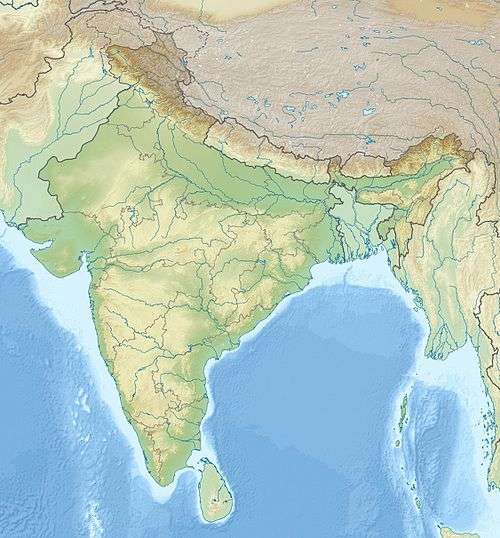
 Chau Chau Kang Nilda Location in northern India | |
| Location | Himachal Pradesh, India |
| Parent range | Himachal Pradesh Himalayas |
| Climbing | |
| First ascent |
1939 by J. O. M. Roberts [3] |
Chau Chau Kang Nilda also known as 'Guan Nelda' or 'blue moon in the sky' [4] is a mountain in the western Himalayas. It lies in the northern Indian state of Himachal Pradesh.
The mountain located 13 km northeast of Kaza, the main town in Spiti, in the district of Lahaul and Spiti district.

View of CHAU CHAU KANG NILDA peak near Demul village
Climbing history
The Chau Chau Kang Nilda was first climbed in 1939 by J.O.M. Roberts (James Owen Roberts Merion) who crossed Spiti from Kullu .He became the first mountaineer to visit Spiti .[5] Indian expeditions climbed Chau Chau Kang Nilda[6] in 1966 and again in 1981[7]
References
- ↑ "Himalayan Index - Results of Search by Name". Alpine-club.org.uk. Retrieved 2016-07-08.
- ↑ "Himalayan Index - Results of Search by Name". Alpine-club.org.uk. Retrieved 2016-07-08.
- ↑ H.J. Vol. XII, p. 129.
- ↑ Manohar Singh Gill. "Himalayan Wonderland: Travels in Lahaul and Spiti". Books.google.co.in. p. 260. Retrieved 2016-07-08.
- ↑ Harish Kapadia. "Spiti: Adventures in the Trans-Himalaya". Books.google.co.in. p. 185. Retrieved 2016-07-08.
- ↑ H.T- Vol. XVII, p. 185.
- ↑ H.J. Vol. 39, p. 198.
External links
This article is issued from Wikipedia - version of the 7/30/2016. The text is available under the Creative Commons Attribution/Share Alike but additional terms may apply for the media files.