Chicken's Neck (Pakistan)
| Akhnoor Dagger | |
|---|---|
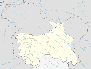 Akhnoor Dagger Location in Jammu and Kashmir | |
| Coordinates: 32°52′N 74°44′E / 32.87°N 74.73°ECoordinates: 32°52′N 74°44′E / 32.87°N 74.73°E | |
| Country |
|
| Administrative units | Azad Kashmir |
| District | Sialkot |
| Elevation | 301 m (988 ft) |
| Languages | |
| • Official | Urdu |
| Languages | |
| • Secondary official | Dogri, Gojri, Punjabi |
| Time zone | PST (UTC+5:00) |
The Chicken's Neck, or the Akhnoor Dagger,[1] is the name for a narrow strip of Pakistani territory that extends into the Indian state of Jammu and Kashmir south of Akhnoor. This sensitive piece of land, which lies on the de facto Indo-Pakistani border on the west side of the disputed region of Kashmir, is part of Punjab Province's Sialkot District and measures roughly 170 km². It has been a focal point in all the wars between India and Pakistan, as it is seen as a corridor towards most of Jammu and Kashmir. One of the main thrusts of Operation Grand Slam in the Indo-Pakistani War of 1965 was to capture Akhnoor through the Chicken's Neck, which could potentially have choked the Indian Army in the region; however, the plan failed. During the 1971 war Indian troops of the 19 Infantry Brigade under Brigadier General (later Lieutenant General) Mohindar Singh were able to take possession of this strip of land.[1]
References
- 1 2 "Chicken's Neck 'wrung' by Zoru." The Liberation Times. 7 December 1971. Reproduced at Bharat-Rakshak.com. Accessed 25 May 2008.