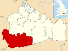
Churt
| Churt | |
 Coniferous woods in Whitmore Vale, Churt |
|
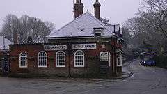 The Crossways Inn in winter's snow |
|
 Churt |
|
| Area | 4.68 km2 (1.81 sq mi) |
|---|---|
| Population | 1,202 (Civil Parish 2011)[1] |
| – density | 257/km2 (670/sq mi) |
| OS grid reference | SU8638 |
| Civil parish | Churt |
| District | Waverley |
| Shire county | Surrey |
| Region | South East |
| Country | England |
| Sovereign state | United Kingdom |
| Post town | Farnham |
| Postcode district | GU10 |
| Dialling code | 01252 and 01428 |
| Police | Surrey |
| Fire | Surrey |
| Ambulance | South East Coast |
| EU Parliament | South East England |
| UK Parliament | South West Surrey |
Coordinates: 51°08′10″N 0°46′37″W / 51.136°N 0.777°W
Churt is a village and civil parish in the borough of Waverley in Surrey, England. It is on the A287 road between Hindhead and Farnham. A clustered settlement set in areas acting as its green buffers, which include the Devil's Jumps. The west of the village declines in height to the steep edge of Whitmore Vale, which is itself mostly in Headley, Hampshire. At the foot of this bank is a steeply cut brook which defines the Hampshire border. Old boundary stones are visible at the junction of Green Lane and Green Cross Lane. The town of Farnham is centred 5.5 miles (8.9 km) north. The village has forests and heathland by and atop the Greensand Ridge, at a lesser height than, for example, Gibbet Hill, Hindhead 3 miles (4.8 km) south east.
History
Its origins are Saxon. The village as Churt and Cherte[2] is recorded in the 14th century as part of the "Great Sacks", and a tything of Farnham of the Bishop of Winchester – a subsidy roll assessed it with a figure: £3 9s ¼d, (very roughly equivalent to £2,230 in 2015) presumably annually.[3] Frensham Great Pond, dug to provide one such spiritual leader, Hædde, with fresh fish, is less than 10m beyond the north border. Upon the establishment of the chapelry of Frensham in the 13th century, it became part of that entity short of a parish, which stretched as far south as Shottermill, a neighbourhood today of western Haslemere.[4] Stating how the high common land was for tenants here of the lord of the manor, a court leet of 1540 ordered John Baker not to overburden it with his cattle ('beasts').[3] A case (in the national Court of the Exchequer) of 1692 asked whether Churt was in the Weald and whether wood cut from such land was tithe-free, and the juries answered both questions in the affirmative, the judges approved and refused a further appeal.
Approximately opposite the parish church which built shortly before it became a parish in 1865, is the old forge built in about 1600.[5] A barn in the western fields next to the farmhouse of Green Cross Farm was built in the 16th century (in wooden Tudor architecture on a brick plinth)[6]
In 1892 George Cubitt, 1st Baron Ashcombe enlarged the chancel of the relatively young church.[3] By the early 20th century Hankley, Bordon and Bramshott had a heavy military presence.[7]
Geography
The parish is roughly square and gradually slopes down to the north-west and steeply by the western border where it is drained by a straight brook (feeding into the Wey) which demarcates the border with Hampshire. In the north are sudden hills, or knolls, three of which are described as 'curiously conical sandhills' in the Victoria County History (1911),[3] and are recorded on maps as The Devil's Jumps.
The town of Farnham is centred 5.5 miles (8.9 km) north and the village sits in forests and heathland by and atop acidic sands of largely uneroded sandstone (the local form, Bargate stone) north of the escarpment of the Greensand Ridge.[8]
Notable residents
Industrialist Frank Mason spent the later part of his life in the area and provided the community with the village hall which remains the hub of the village.
The BBC's Blue Peter presenter John Noakes and his much-filmed pet Shep lived here, as did golf commentator Peter Alliss. Kevin Keegan lived in Green Lane when playing for Southampton Football Club.
Frances Stevenson, wife of British Prime Minister David Lloyd George lived in the village; some of his descendants are here. The cricketing brothers Harry Walker and Thomas Walker were born in the village. The journalist Anthony Loyd grew up in Churt. The Police's drummer, Stuart Copeland, had a short spell in the village with his family. Lord John Hunt lived for a period in the village; he was the leader of the Everest expedition in 1953 and had a decorated military career. Roger Black, Olympic Gold medal winner, also lives in the village.
The amateur astronomer Richard Carrington, whose 1859 astronomical observations first corroborated the existence of solar flares, moved to Churt in 1865. He founded a private observatory and lived here until his death in 1875.[9][10]
Sports clubs
Churt Recreation Ground is home to Churt Juniors Football Club, which caters for children in age groups from Under 5s to Under 11s. Children from Under 7s and above play matches in the North East Hampshire Youth League.
Demography and housing
| Output area | Detached | Semi-detached | Terraced | Flats and apartments | Caravans/temporary/mobile homes | shared between households[1] |
|---|---|---|---|---|---|---|
| (Civil Parish) | 320 | 101 | 33 | 38 | 2 | 0 |
The average level of accommodation in the region composed of detached houses was 28%, the average that was apartments was 22.6%.
| Output area | Population | Households | % Owned outright | % Owned with a loan | hectares[1] |
|---|---|---|---|---|---|
| (Civil Parish) | 1,202 | 494 | 41.5% | 32.6% | 468 |
The proportion of households in the civil parish who owned their home outright compares to the regional average of 35.1%. The proportion who owned their home with a loan compares to the regional average of 32.5%. The remaining % is made up of rented dwellings (plus a negligible % of households living rent-free).
Local government
One of the 81 councillors of Surrey County Council serves the area, who sits for Waverley Western Villages.[11]
The relevant ward for the borough council is Frensham, Dockenfield and Tilford. Churt Parish Council meetings are open to the public.
See also
- Baron Nathan of Churt, a title in the Peerage of the United Kingdom created in 1940
References
- 1 2 3 Key Statistics; Quick Statistics: Population Density United Kingdom Census 2011 Office for National Statistics Retrieved 21 November 2013
- ↑ H. E. Malden (editor) (1906). "Parishes: Frensham: Churt". A History of the County of Surrey: Volume 2 p.609. The Internet Archive. Retrieved 25 November 2013.
- 1 2 3 4 H. E. Malden (editor) (1906). "Parishes: Frensham: Churt". A History of the County of Surrey: Volume 2 p.613. The Internet Archive. Retrieved 25 November 2013.
- ↑ H. E. Malden (editor) (1906). "Parishes: Frensham: Churt". A History of the County of Surrey: Volume 2 p.580. The Internet Archive. Retrieved 25 November 2013.
- ↑ Historic England. "Details from listed building database (1352733)". National Heritage List for England. Retrieved 2 December 2013.
- ↑ Historic England. "Details from listed building database (1044430)". National Heritage List for England. Retrieved 2 December 2013.
- ↑ Woolmer Forest Heritage Society
- ↑ Grid square map Ordnance survey website
- ↑ Biography at the HAO Archived 4 December 2009 at the Wayback Machine.
- ↑ Article on Carrington at the Times
- ↑ My Council Surrey County Council Retrieved 2 December 2013
External links
| Wikimedia Commons has media related to Churt. |
- Churt Parish Council Village Website
- A Brief History Of Churt
- Listed Buildings in Churt, Surrey, England
- Stained Glass Windows at St. John, Churt, Surrey