Ciglence
| Ciglence | |
|---|---|
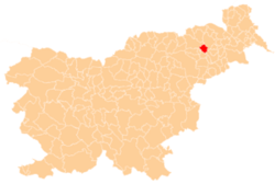
 Ciglence Location in Slovenia | |
| Coordinates: 46°29′49″N 15°46′48.44″E / 46.49694°N 15.7801222°ECoordinates: 46°29′49″N 15°46′48.44″E / 46.49694°N 15.7801222°E | |
| Country |
|
| Traditional region | Styria |
| Statistical region | Drava |
| Municipality | Duplek |
| Area | |
| • Total | 2.96 km2 (1.14 sq mi) |
| Elevation | 334.9 m (1,098.8 ft) |
| Population (2002) | |
| • Total | 307 |
| [1] | |
Ciglence (pronounced [tsiˈɡleːntsɛ]) is a settlement in the Municipality of Duplek in northeastern Slovenia. It lies on the southwestern edge of the Slovene Hills (Slovene: Slovenske gorice), southeast of Maribor. The area is part of the traditional region of Styria. The municipality is now included in the Drava Statistical Region.[2]
The village chapel-shrine with a small belfry dates to the early 20th century. There are two other small roadside chapel-shrines in the settlement. One dates to the first half of the 19th century and the second to the late 19th century.[3]
References
- ↑ Statistical Office of the Republic of Slovenia
- ↑ Duplek municipal site
- ↑ Slovenian Ministry of Culture register of national heritage reference numbers ešd 16804 & 8953 & 27545
External links
| Settlements | Administrative centre: Spodnji Duplek
|  | ||||||
|---|---|---|---|---|---|---|---|---|
This article is issued from Wikipedia - version of the 7/17/2015. The text is available under the Creative Commons Attribution/Share Alike but additional terms may apply for the media files.