Clare Municipal Airport
| Clare Municipal Airport | |||||||||||||||
|---|---|---|---|---|---|---|---|---|---|---|---|---|---|---|---|
.png) | |||||||||||||||
| IATA: none – ICAO: none – FAA LID: 48D | |||||||||||||||
| Summary | |||||||||||||||
| Airport type | Public | ||||||||||||||
| Owner | City of Clare | ||||||||||||||
| Location | Clare, Michigan | ||||||||||||||
| Elevation AMSL | 857 ft / 261 m | ||||||||||||||
| Coordinates | 43°50′04″N 084°44′25″W / 43.83444°N 84.74028°W | ||||||||||||||
| Website | www.clare48d.com | ||||||||||||||
| Map | |||||||||||||||
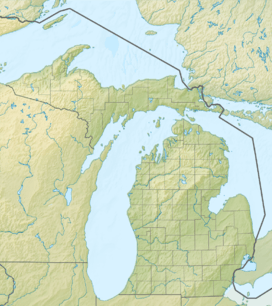 48D  48D Location of airport in Michigan/United States | |||||||||||||||
| Runways | |||||||||||||||
| |||||||||||||||
| Statistics (2005) | |||||||||||||||
| |||||||||||||||
Clare Municipal Airport (FAA LID: 48D) is a public airport located one mile (2 km) east of downtown Clare, a city in Clare County, Michigan, United States.[1] The airport became active in 1941. It serves general aviation for Clare and the surrounding area. It is included in the Federal Aviation Administration (FAA) National Plan of Integrated Airport Systems for 2017–2021, in which it is categorized as a local general aviation facility.[2]
Facilities and aircraft
Clare Municipal Airport covers an area of 200 acres (81 ha) which contains two asphalt paved runways: 4/22 measuring 3,500 x 75 ft (1,067 x 23 m) and 9/27 measuring 2,500 x 75 ft (762 x 23 m).[1]
For the 12-month period ending December 31, 2005, the airport had 5,384 general aviation aircraft operations, an average of 14 per day. There are 22 aircraft based at this airport: 91% single-engine and 9% multi-engine.[1]
References
- 1 2 3 4 FAA Airport Master Record for 48D (Form 5010 PDF), effective 2007-10-25
- ↑ "List of NPIAS Airports" (PDF). FAA.gov. Federal Aviation Administration. 21 October 2016. Retrieved 25 November 2016.
External links
- Clare Municipal Airport (official site)
- State of Michigan - Airport Profile
- FAA Airport Contact (Clare Municipal)
- Resources for this airport:
- FAA airport information for 48D
- AirNav airport information for 48D
- FlightAware airport information and live flight tracker
- SkyVector aeronautical chart for 48D