Cleveland Hopkins International Airport (RTA Rapid Transit station)
| |||||||||||
|---|---|---|---|---|---|---|---|---|---|---|---|
| Rapid Station | |||||||||||
 | |||||||||||
| Location |
5300 Riverside Drive Cleveland, Ohio 44135 United States | ||||||||||
| Coordinates | 41°24′40″N 81°50′15″W / 41.41111°N 81.83750°WCoordinates: 41°24′40″N 81°50′15″W / 41.41111°N 81.83750°W | ||||||||||
| Owned by | Greater Cleveland Regional Transit Authority | ||||||||||
| Line(s) | |||||||||||
| Platforms | 1 island platform | ||||||||||
| Tracks | 2 | ||||||||||
| Connections |
| ||||||||||
| Construction | |||||||||||
| Structure type | Underground | ||||||||||
| Parking | Paid airport parking only | ||||||||||
| Disabled access | Yes | ||||||||||
| Other information | |||||||||||
| Website | Airport Rapid Station | ||||||||||
| History | |||||||||||
| Opened | November 15, 1968 | ||||||||||
| Rebuilt | May 1994 | ||||||||||
| Services | |||||||||||
| |||||||||||
| Location | |||||||||||
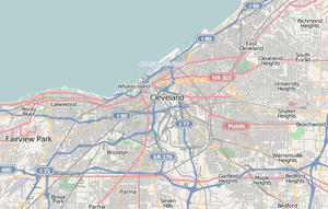
Location within Cleveland | |||||||||||
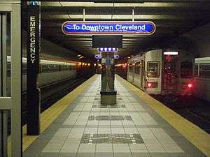
Cleveland Hopkins International Airport is a station on the RTA Red Line in Cleveland, Ohio, USA. It is the western terminus of the Red Line and is located off the lower level below the middle of the baggage claim level of Cleveland Hopkins International Airport.
Notable places nearby
History
The station opened on November 15, 1968 when the CTS Rapid Transit was extended four miles from West Park station, making Cleveland the first city in the Western Hemisphere to offer direct rapid transit service to its major airport.[1] A $1.9-million renovation of the station was completed in May 1994.[1]
RTA has considered extending the Red Line beyond Hopkins Airport to Berea.[2] Several different plans were considered in the late 1990s. One plan would have extended the Red Line from Hopkins Airport along Ohio State Route 237 past the I-X Center and into downtown Berea. Another plan would have the rapid extend from the Brookpark station past the I-X Center and into Berea. The proposal included the possibility that direct service to the airport terminal would end, with a new station outside the airport grounds which would require riders to be transferred to the terminal by other means. However, the extension failed to obtain approval of the Northeast Ohio Areawide Coordinating Agency, because it was too expensive and would not attract enough riders.[3]
RTA continues to consider Red Line extensions to development areas adjacent to the airport, and an extension along the southwest corridor to the I-X Center, Berea or the growing areas of Lorain County is included as part of RTA's long range plan, Transit 2025.[4] RTA is also working with the City of Cleveland, the State of Ohio, and other passenger rail interests to create an Amtrak station near Hopkins Airport, which would serve as an intermodal airport hub similar to those in Newark, Baltimore, or Milwaukee.[5]
References
- 1 2 "About RTA: History of Public Transit in Greater Cleveland". RTA Website. Retrieved 2007-06-03.
- ↑ "RTA approves $1 million to assess Berea line". The (Cleveland) Plain Dealer. 1997-04-23. pp. 2B. Retrieved 2007-06-02.
- ↑ Sweeney, James F. (2000-04-20). "Costs may halt Red Line extension". The (Cleveland) Plain Dealer. pp. 1B. Retrieved 2007-06-02.
- ↑ "Transit 2025 Plan" (PDF). Greater Cleveland Regional Transit Authority. March 2006. ch. 4: 5–6. Check date values in:
|date=(help);|chapter=ignored (help) - ↑ "Greater Cleveland RTA rail planning updates". Transportation Choices. EcoCity Cleveland. Retrieved 2007-06-20.
External links
- Public Transit page at Cleveland Hopkins International Airport website
 Media related to Cleveland Hopkins International Airport (RTA Rapid Transit station) at Wikimedia Commons