Cocos (Keeling) Islands Airport
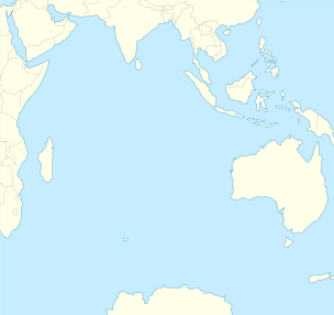
Cocos (Keeling) Island Airport (IATA: CCK, ICAO: YPCC) is an airport serving the Cocos (Keeling) Islands, a territory of Australia located in the Indian Ocean. The airport is located on West Island, one of the South Keeling Islands and capital of the territory.
History

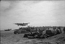
The airfield was built during World War II to support Allied aircraft in the war against Japan.
Facilities
The airport has one runway, designated 15/33, with an asphalt surface measuring 2,441 m × 45 m (8,009 ft × 148 ft) and an elevation of 10 ft (3 m) above sea level.[2]
Airlines and destinations
| Airlines | Destinations |
|---|---|
| Virgin Australia | Christmas Island, Perth |
Statistics
Cocos Island Airport is not one of the busiest in Australia but still served 15,712 revenue passengers during financial year 2010–2011.[1][3]
| Year[1] | Revenue passengers | Aircraft movements |
|---|---|---|
| 2001–02 | 4,740 | 218 |
| 2002–03 | 4,328 | 212 |
| 2003–04 | 4,976 | 218 |
| 2004–05 | 5,631 | 226 |
| 2005–06 | 5,632 | 224 |
| 2006–07 | 6,501 | 232 |
| 2007–08 | 6,510 | 320 |
| 2008–09 | 5,611 | 238 |
| 2009–10 | 9,129 | 302 |
| 2010–11 | 15,712 | 303 |
See also
References
- 1 2 3 Fiscal year 1 July – 30 June
- 1 2 YPCC – Cocos (Keeling) Island (PDF). AIP En Route Supplement from Airservices Australia, effective 10 November 2016, Aeronautical Chart
- 1 2 3 "Airport Traffic Data 1985–86 to 2010–11". Bureau of Infrastructure, Transport and Regional Economics (BITRE). May 2012. Archived from the original on 24 March 2012. Retrieved 27 June 2012. Refers to "Regular Public Transport (RPT) operations only"
External links
| Wikimedia Commons has media related to Cocos (Keeling) Islands Airport. |
This article is issued from Wikipedia - version of the 12/4/2016. The text is available under the Creative Commons Attribution/Share Alike but additional terms may apply for the media files.
_Islands_Airport_-_RWY33.jpg)

_Islands_Airport_-_RWY15.jpg)
_76.jpg)