Colombia–Panama border
The Colombia–Panama border is the international boundary between Colombia and Panama. It is also the border between South America and North America.
History
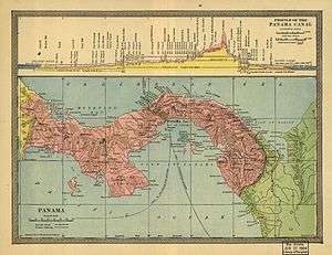
Borders of Panama in 1904
Formerly, the regional border was initially created in 1508 after royal decree, to separate the colonial governorships of Castilla de Oro and Nueva Andalucía, using the River Atrato as the boundary between the two goverorships.[1]
The current limit was regulated by the Victoria-Velez Treaty signed in Bogota on August 20, 1924 by the Foreign Ministers of Panama, Nicolas Victoria; and Colombia, Jorge Velez. This treaty is officially registered in the Register No. 814 of the Treaty League of Nations, on 17 August 1925. The border was made based on the same Colombian law of June 9, 1855.[2]
References
This article is issued from Wikipedia - version of the 4/1/2016. The text is available under the Creative Commons Attribution/Share Alike but additional terms may apply for the media files.