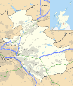
Condorrat
Coordinates: 55°56′02″N 4°01′16″W / 55.934°N 4.021°W
Condorrat was a village in North Lanarkshire, Scotland. It is now part of Cumbernauld but retains some of its own character.
The name Condorrat is from the Gaelic "Comh Dobhair Alt" - The joint river place.[1] The Luggie Water flows round the southern perimeter of Condorrat where older maps[2] seem to show it was joined by the Moss Water. This is probably the meaning of the phrase.[3] (In 1993 Broadwood Loch, a balancing lake, was created by damming the Moss Water and using a plastic waterproof membrane, and a 6m wall to hold back the water.[4] This was primarily to prevent flooding downstream but also for recreation).
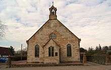
The settlement pre-dates 1649, as Groome's Ordinance Gazetteer of Scotland states "The parish, containing also the village of Condorrat, was disjoined from Kirkintilloch in 1649, under the name of Easter Lenzie." The same publication also states that Condorrat is a quoad sacra parish in Cumbernauld parish, Dumbartonshire, 2 and 3/4 miles southwest of Cumbernauld Village and 6 miles north-northwest of Airdrie, under which, it has a post office. An Established church built here in 1875, contain 400 sittings, and cost, with a manse, £2600. Pop (1891) 607 of q.s. parish, 1596." [5]
Over the past few decades it has been subsumed by the new town of Cumbernauld. In fact Cumbernauld new town was built around older settlements at Condorrat,[6] Cumbernauld Village and Hebron Hill (Abronhill).
Up until 1975 Condorrat sat within Cumbernauld Burgh and Dunbartonshire County. Upon local government re-organisation in 1975 it found itself part of Cumbernauld & Kilsyth District Council and Strathclyde Regional Council. Finally, in 1995, it was placed within the boundaries of the newly created North Lanarkshire Council.
A Dalshannon Farm was located in the area, and it now gives its name to another part of Cumbernauld, Dalshannon, to the West of Condorrat.

Condorrat is the birthplace of the 19th century nationalist figure John Baird, a leading participant in the Radical War of 1820. A plaque is mounted outside the house in which he was born (Airdrie Road).
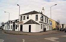
Condorrat was a weaving community and some of the early single storey houses still exist in the row known as Braehead Cottages - now much modernised. At the west end of the town is Dalshannon Farm which is a very good example of a long house of the 17th century. The longhouse has since been raised in height and a 2 storey block added to the NW corner.
Condorrat now has many of its own facilities including a Health Centre, 3 primary schools and a library.[7]
References
- ↑ http://theses.gla.ac.uk/5270/1/2014DrummondPhD.pdf#229 For historical pronunciations
- ↑ http://maps.nls.uk/view/75650196 Map of Old Condorrat (bottom right)
- ↑ http://theses.gla.ac.uk/5270/1/2014DrummondPhD.pdf#229 Other possible meanings of Cundurat
- ↑ http://www.scottish-places.info/features/featurefirst18072.html Broodwood Loch
- ↑ http://www.gazetteerofscotland.org.uk/ search on Condorrat
- ↑ "Dumbartonshire 034.05 (includes: Cumbernauld; Kirkintilloch; New Monkland) 1986". National Library of Scotland. Retrieved 10 August 2016.
- ↑ http://www.scottish-places.info/towns/townfirst1431.html link to Scottish Place site