Connecticut Route 77
| ||||
|---|---|---|---|---|
|
Map of southern Connecticut with Route 77 highlighted in red | ||||
| Route information | ||||
| Maintained by ConnDOT | ||||
| Length: | 13.85 mi[1] (22.29 km) | |||
| Existed: | 1932 – present | |||
| Major junctions | ||||
| South end: |
| |||
|
| ||||
| North end: |
| |||
| Location | ||||
| Counties: | New Haven, Middlesex | |||
| Highway system | ||||
| ||||


Route 77 is a secondary state highway in southern Connecticut. It is a state-designated scenic road and runs from the Guilford town green, through North Guilford, into the town center of Durham.
Route description
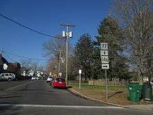
Route 77 begins at an intersection with Route 146 at the Guilford town green as Whitfield Street. It runs around the west side of the green, then shifts to Church Street as it leaves the green. Route 77 crosses US 1 and I-95 (at exit 58), becoming the main road through the northern part of Guilford, past Lake Quonnipaug. Between I-95 and the Durham town line, Route 77 is known as Durham Road. It has a junction with Route 80 (leading to Killingworth and North Branford) about 5.4 miles (8.7 km) north of I-95, then crosses into the town of Durham, where the road changes name to Guilford Road. Route 77 runs for another 2.3 miles (3.7 km) in Durham and ends at an intersection with Route 17 just south of the town center, near the northern end of Route 79. The entire route is classified as a collector road and carries average daily traffic volumes of about 5,900 vehicles.[1]
Special designations
Route 77 is a designated state scenic road for its entire length.[2]
History
The road from Guilford center to Durham center was chartered as a private turnpike in 1824, known as the Guilford and Durham Turnpike. In 1922, Connecticut took over the maintenance of the main through routes and State Highway 112 was established, incorporating the old turnpike alignment from Guilford to Durham and extending north beyond Durham into Middletown (along modern Route 17). In the 1932 state highway renumbering, Route 77 was created from the portion of old Highway 112 south of Durham center. The portion north of Durham center became part of Route 15 (now Route 17). The original Route 77 ended at US 1. It was extended south to Route 146 in 1962.[3]
Junction list
| County | Location | mi[1] | km | Destinations | Notes |
|---|---|---|---|---|---|
| New Haven | Guilford | 0.00 | 0.00 | ||
| 0.50 | 0.80 | ||||
| 1.04 | 1.67 | I-95 Exit 58 | |||
| 5.46 | 8.79 | ||||
| Middlesex | Durham | 13.85 | 22.29 | Northern terminus of CT 77 | |
| 1.000 mi = 1.609 km; 1.000 km = 0.621 mi | |||||