Constitution Trail
| Constitution Trail | |
|---|---|
|
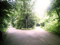
A "fork" or the "Y" in the trail featuring an old railway signal. | |
| Established | May 6, 1989 |
| Use | Running, walking, biking, inline skating |
| Hiking details | |
| Trail difficulty | Easy |
| Season | All |
| Surface | Asphalt |
| Website |
www |
The Constitution Trail is a multi-use rail trail located in Illinois. It occupies an abandoned Illinois Central Gulf Railroad corridor that runs through the 'Twin Cities' of Bloomington and Normal in McLean County, Illinois.
The trail, which is owned by the municipalities of Bloomington and Normal, is used by bikers, inline skaters, walkers, runners and skiers, and covers approximately 24 mi (39 km). of former railways. It features the Camelback Bridge in Normal, a site on the U.S. National Register of Historic Places. Its official opening was May 6, 1989. In 2000, the trail was officially named a "Millennium Trail" by the White House Millennium Council.[1]
-
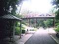
Camelback Bridge, overlooking the trail.
-

One of the many wooden bridges overlooking Bloomington City streets.
Structure
In addition to the main strip of the trail, there are several branches that lead to more remote areas of the Bloomington-Normal area. The main strip begins at Croxton Avenue, Southeast of Downtown Bloomington and extends north to Kerrick Rd. north of Normal. For most of the trail's extent the trail is proximal to Linden Street. The trail currently ends at these points; however, there are multiple branches extending from this route or very close to this route. There is a branch in the north that may be picked up at Linden St. and extends along Raab Rd. to Towanda Ave. The West branch of the trail can be accessed at Vernon Ave. and extends to the Northwest past Illinois State University Golf Course (between Raab Rd. and Gregory St.), and ends at Heartland Community College on Raab Road. The east branch is near Vernon Ave. and extends to past Airport Rd. to route 29 (with a few additional branches in that area). The southwest branch begins at Lincoln Street and extends through the southern downtown area of Bloomington and continues west to Illinois Route 9 west of Bloomington. The southeast branch is picked up at Hamilton Road north of the State Farm Corporate building and extends from Commerce Parkway to Streid Drive.
There are other smaller sections of trail located in various places around Bloomington and Normal, and there are also "proposed" sections of trail that will effectively link most of these scattered sections together.
References
- ↑ "A Brief History". Friends of the Constitution Trail. Archived from the original on 2008-05-02. Retrieved 2008-08-07.