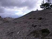
Crystal Peak (Sierra County, California)
| Crystal Peak | |
|---|---|
 Crystal Peak | |
| Highest point | |
| Elevation | 8,107 ft (2,471 m) [1] |
| Prominence | 263 ft (80 m) [1] |
| Coordinates | 39°33′28″N 120°05′18″W / 39.55778°N 120.08833°WCoordinates: 39°33′28″N 120°05′18″W / 39.55778°N 120.08833°W |
| Geography | |
| Location | Sierra County, California |
| Parent range | Bald Mountain Range, Sierra Nevada |
Crystal Peak is a mountain in Sierra County, California. It is located on the south end of the Bald Mountain Range, 3 mi (4.8 km) northeast of Sardine Valley and 16 mi (25.6 km) northwest of Reno, Nevada.[2]
Crystal Mine
The back half of the Crystal Mine (which is much larger)
The first recorded visit to the Crystal Peak (on which the mine is located) was in 1845 by a Stevens wagon train. After the town of Crystal was abandoned, the local roads fell into disrepair (later being reconstructed in 1992).[3]
Access to the Crystal Mine is currently available to the public for non-commercial purposes, though a limit of one 5 gallon bucket of crystals per vehicle per week is in effect.
References
- 1 2 "Crystal Peak". Peakbagger.com.
- ↑ "Crystal Peak". Geographic Names Information System. United States Geological Survey. Retrieved August 17, 2015.
- ↑ "Zephyr Outdoors - Crystal Peak".
 This article incorporates public domain material from websites or documents of the United States Geological Survey.
This article is issued from Wikipedia - version of the 12/26/2015. The text is available under the Creative Commons Attribution/Share Alike but additional terms may apply for the media files.