Cumberland Coalfield
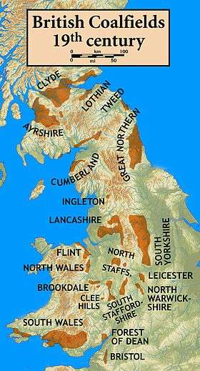
The Cumberland Coalfield is a coalfield in Cumbria, north-west England. It extends from Whitehaven in the south to Maryport and Aspatria in the north.[1]
Geology
The following coal seams occur within the Coal Measures Group in this coalfield.[2][3] Not all seams are present in any one part of the coalfield:
Middle Coal Measures Formation
- (series of unnamed coals)
- Brassy
- Black Metal
- Fireclay
- White Metal
- Little
- Slaty
- Tenquarters
- Rattler
- Bannock Band
- Main Band
- Lower Metal
- Yard Cannel Band
- Yard
- Lower Yard
There is also a Crow seam between the Metal and Bannock seams.
Lower Coal Measures Formation
- Half Yard
- Two Foot
- Little Main
- Eighteen Inch
- Lickbank
- Sixquarters
- Parrot
- Upper Threequarters Rider
- Upper Threequarters
- Lower Threequarters
- Upper Albrighton
- Middle Albrighton
- Lower Albrighton
- Harrington Four Foot
Towards the top of the underlying Stainmore Formation (or Hensingham Formation), which is of Namurian age, are the:
- Udale Coal
- Bedlam Gill Coal
- (unnamed coals)
See also
References
- ↑ British Geological Survey 2007 Bedrock geology: UK North 1:625,000 scale geological map, BGS, Keyworth, Notts
- ↑ Stone P. et al. 2010. British Regional Geology: Northern England (5th Edn), (Keyworth, Notts, British Geological Survey)
- ↑ British Geological Survey 1:50,000 scale geological map sheets (England & Wales) 23 Cockermouth and 28 Whitehaven
Coordinates: 54°38′19″N 3°28′34″W / 54.6387°N 3.4760°W
This article is issued from Wikipedia - version of the 4/24/2013. The text is available under the Creative Commons Attribution/Share Alike but additional terms may apply for the media files.