Curuzú Cuatiá
| Curuzú Cuatiá | ||
|---|---|---|
| City | ||
| ||
 | ||
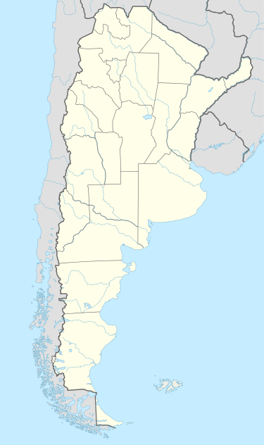 Curuzú Cuatiá Location of Curuzú Cuatiá in Argentina | ||
| Coordinates: 29°47′S 58°5′W / 29.783°S 58.083°WCoordinates: 29°47′S 58°5′W / 29.783°S 58.083°W | ||
| Country | Argentina | |
| Province | Corrientes | |
| Department | Curuzú Cuatiá | |
| Founded | November 16, 1810 | |
| Government | ||
| • Mayor | Alicia Locatelli de Rubin (Justicialist Party) | |
| Elevation | 61 m (200 ft) | |
| Population (2012) | ||
| • Total | 33,089 | |
| Demonym(s) | curuzucuateña/o | |
| Time zone | ART (UTC-3) | |
| CPA base | W3460 | |
| Dialing code | +54 3774 | |
| Website | Official website | |

Curuzú Cuatiá is a city in the south of the province of Corrientes in the Argentine Mesopotamia. It had about 50,000 inhabitants at the 2001 census [INDEC], and is the head town of the Curuzú Cuatiá Department.
The area has an undulated terrain, with many small rivers and streams that empty into the Paraná River in the west, or into the Uruguay River in the east. The climate is wet subtropical, with uniformly distributed annual rainfall of 1,200 mm on average. The average temperatures are 14.5 °C (winter) and 26 °C (summer), with recorded extremes of −3 °C and 44 °C respectively.
The city is served by an airport (IATA: UZU, ICAO: SATU), located at 29°47′S 58°1′W / 29.783°S 58.017°W.
History
The name Curuzú Cuatiá is of Guaraní origin and means "Engraved Cross". The early settlers (Spanish conquistadores and Jesuit missionaries from Uruguay) called it Posta de Cruz since the site was a crossroads, marked by a large cross with an inscription.
After the May Revolution that initiated the struggle for independence of Argentina from Spain, the army led by General Manuel Belgrano passed by. Belgrano solved a government conflict in the area by assigning the jurisdiction to the Cabildo of Corrientes. On 16 November 1810 he dictated the official foundation of the city, which (respecting the wishes and beliefs of the population) he named Nuestra Señora de Pilar de Curuzú Cuatiá ("Our Lady of Pilar of Curuzú Cuatiá").
The area saw several important battles during the centralist-federalist struggle, the most remarkable being the Battle of Pago Largo (31 March 1839) against Entre Ríos supporters of Juan Manuel de Rosas.
The town was officially assigned the category of village (villa) on 9 October 1852, and became a city on 25 October 1888.
Climate
| Climate data for Curuzú Cuatiá (1981–1990) | |||||||||||||
|---|---|---|---|---|---|---|---|---|---|---|---|---|---|
| Month | Jan | Feb | Mar | Apr | May | Jun | Jul | Aug | Sep | Oct | Nov | Dec | Year |
| Average high °C (°F) | 33.0 (91.4) |
30.7 (87.3) |
29.0 (84.2) |
25.1 (77.2) |
21.8 (71.2) |
18.4 (65.1) |
18.7 (65.7) |
21.0 (69.8) |
21.9 (71.4) |
25.9 (78.6) |
28.3 (82.9) |
31.4 (88.5) |
25.4 (77.7) |
| Daily mean °C (°F) | 26.9 (80.4) |
25.1 (77.2) |
23.3 (73.9) |
19.5 (67.1) |
16.3 (61.3) |
12.9 (55.2) |
12.7 (54.9) |
15.2 (59.4) |
16.2 (61.2) |
19.8 (67.6) |
22.7 (72.9) |
25.3 (77.5) |
19.7 (67.5) |
| Average low °C (°F) | 19.8 (67.6) |
19.4 (66.9) |
17.3 (63.1) |
14.1 (57.4) |
10.5 (50.9) |
7.7 (45.9) |
7.3 (45.1) |
9.1 (48.4) |
10.3 (50.5) |
12.9 (55.2) |
16.1 (61) |
17.9 (64.2) |
13.5 (56.3) |
| Average precipitation mm (inches) | 123.9 (4.878) |
153.7 (6.051) |
152.3 (5.996) |
201.6 (7.937) |
99.9 (3.933) |
79.4 (3.126) |
50.1 (1.972) |
50.6 (1.992) |
112.2 (4.417) |
129.1 (5.083) |
132.2 (5.205) |
90.1 (3.547) |
1,375.1 (54.138) |
| Average precipitation days | 8 | 9 | 8 | 9 | 6 | 8 | 6 | 6 | 8 | 8 | 7 | 6 | 89 |
| Average relative humidity (%) | 62 | 72 | 73 | 79 | 79 | 82 | 79 | 74 | 75 | 69 | 69 | 61 | 73 |
| Source: Servicio Meteorologico Nacional[1] | |||||||||||||
References
- ↑ "Datos Estadísticos (Período 1981-1990)" (in Spanish). Servicio Meteorologico Nacional. Retrieved February 13, 2016.
- Municipal information: Municipal Affairs Federal Institute (IFAM), Municipal Affairs Secretariat, Ministry of Interior, Argentina. (Spanish)
- Municipality of Curuzú Cuatiá - Official website.