Dalgety Bay
| Dalgety Bay | |
| Scottish Gaelic: Bàgh Dhealgadaidh | |
| Scots: Dawgety | |
 |
|
 Dalgety Bay |
|
| Population | 10,030 [1] |
|---|---|
| OS grid reference | NT149841 |
| Council area | Fife |
| Lieutenancy area | Fife |
| Country | Scotland |
| Sovereign state | United Kingdom |
| Post town | Dunfermline |
| Postcode district | KY11 |
| Dialling code | 01383 |
| Police | Scottish |
| Fire | Scottish |
| Ambulance | Scottish |
| EU Parliament | Scotland |
| UK Parliament | Kirkcaldy and Cowdenbeath |
| Scottish Parliament | Kirkcaldy |
Coordinates: 56°02′35″N 3°22′03″W / 56.04295°N 3.36755°W
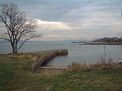
Dalgety Bay (![]() i/dælˈɡɛti ˈbeɪ/, Scots: Dawgety[2]) is a coastal town and parish in Fife, Scotland, on the north shore of the Firth of Forth. According to Fife Council, the town is home to 10,030, making this the eighth-largest place in Fife.[1] The civil parish has a population of 10,777 (in 2011).[3]
i/dælˈɡɛti ˈbeɪ/, Scots: Dawgety[2]) is a coastal town and parish in Fife, Scotland, on the north shore of the Firth of Forth. According to Fife Council, the town is home to 10,030, making this the eighth-largest place in Fife.[1] The civil parish has a population of 10,777 (in 2011).[3]
The bay was named after the original village of Dalgety, but the ruins of the 12th century St Bridget's Kirk are all that now mark the site. The new town, which was built in 1962, takes its name from the main bay it adjoins, but the town stretches over many bays and coves including Donibristle Bay and St David's Bay.
Today, Dalgety Bay is a dormitory suburb of Edinburgh. While the architecture of the town reflects construction by volume housebuilders, the town is a regular winner of the Best Kept Small Town title. Its rise in population mirrors its rise in popularity as a coastal commuter town.[4]
A series of radioactive objects have been found on the shoreline of Dalgety Bay since the 1990s. The objects come from eroded landfill that contains debris from Second World War aircraft that originally had radium dials. In 2013, the Scottish Environment Protection Agency found that the Ministry of Defence was solely responsible for the contamination.
Dalgety Bay contains 9 Listed Buildings or structures.
History
Dalgety Bay began as the village of Dalgety, which was built on the site of the 12th century St Bridget's Kirk. The land surrounding the town was part of the estate owned by the Earls of Moray who built Donibristle House as their residence. Towards the end of the 18th century, the village was removed by order of the Earls of Moray.[5] During the First World War Morton Gray Stuart, 17th Earl of Moray donated a portion of his land to the Crown, which built an airfield there in 1917 as a base for the Royal Naval Air Service. The town also sent 30 men to war in the First World War, with only 8 returning unharmed. The Royal Naval Air Service improved and expanded the aerodrome during the Second World War as HMS Merlin, an aircraft repair yard, and constructed an extensive aircraft maintenance facility there.
Construction of the modern town of Dalgety Bay as Scotland's first "enterprise town" began around 1962 on the land of the airstrip and much of the remaining ground of the Earls of Moray family seat, Donibristle House.[6] The town stretches across many bays and coves of the northern coast of the Firth of Forth including Donibristle Bay and St David's Bay.
Education
There are two primary schools in Dalgety Bay: Dalgety Bay Primary School and Donibristle Primary School.[7] Dalgety Bay sits within the catchment area for Inverkeithing High School. Pupils attending Private Schools from Dalgety Bay travel to Dollar Academy, by whom a bus is provided, and to the numerous schools in Edinburgh.
Radioactive waste
A series of radioactive objects have been found off the shoreline of Dalgety Bay since the 1990s. One found in 2011 measured 10 megabecquerels. The objects are believed to come from eroded landfill that contains debris from Second World War aircraft that originally had radium dials.[8] On 25 April 2012,the MoD and the Scottish Environment Protection Agency agreed a joint survey of the problem.[9] Since 1990, more than 2,500 radioactive hotspots have been found on the Dalgety Bay foreshore, one-third of them since September 2011. As of 2012, the Ministry of Defence was conducting a 12-month investigation of the contamination to try and avoid Dalgety Bay "becoming the first place in the UK to be legally designated as radioactive contaminated land".[10] In 2013, SEPA concluded that the MoD was solely responsible for the contamination.[11] In early 2014 the MoD made four proposals regarding how to deal with the contamination, ranging from erecting fences to keep the public out, to sealing it in with concrete.[12]
Twin towns — Sister cities
References
- 1 2 "Population Estimates of towns and villages in Fife" (PDF). Fife Council. March 2008. Archived from the original (PDF) on 9 June 2011. Retrieved 2009-03-06.
- ↑ Andy Eagle (2003-02-27). "The Online Scots Dictionary". Scots-online.org. Retrieved 2012-09-15.
- ↑ Census of Scotland 2011, Table KS101SC – Usually Resident Population, publ. by National Records of Scotland. Web site http://www.scotlandscensus.gov.uk/ retrieved March 2016. See “Standard Outputs”, Table KS101SC, Area type: Civil Parish 1930
- ↑ "Welcome to Dalgety Bay & Hillend CC". Retrieved 28 June 2013.
- ↑ Omand The Fife Book p.176.
- ↑ Omand The Fife Book p.90.
- ↑ "Dalgety Bay: Facilities and Services". Fifedirect. Fife Council. Retrieved 12 September 2010.
- ↑ Calire Smith, Scotsman, 16 October 2011.
- ↑ MOD, News Article MOD and SEPA agree Dalgety Bay plan An Estate and Environment, 2012-04-25
- ↑ Rob Edwards (2 May 2012). "Nuclear waste 'may be blighting 1,000 UK sites'". The Guardian.
- ↑ "BBC News - Dalgety Bay radiation: Sepa says MoD was responsible for contamination". BBC Online. Retrieved 28 June 2013.
- ↑ "BBC News - Dalgety Bay radiation: MoD's proposals unveiled". BBC Online. Retrieved 23 January 2014.
External links
- Dalgety Bay on FifeDirect
- Dalgety Bay Round Table
- Dalgety Bay and Hillend community website
- A short tour of Dalgety Bay - includes maps and aerial photographs
- Dalgety Bay Weather Station
- Fleet Air Arm archive
- Radioactive contamination