De Beer's Pass, KwaZulu-Natal
| De Beer's Pass | |
|---|---|
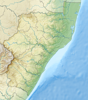 Location in KwaZulu-Natal | |
| Elevation | 1,720 m (5,643 ft)[1] |
| Location | Between Ladysmith and Harrismith, South Africa |
| Coordinates | 28°19′2.8″S 29°29′57.4″E / 28.317444°S 29.499278°ECoordinates: 28°19′2.8″S 29°29′57.4″E / 28.317444°S 29.499278°E |
De Beer's Pass is located in the KwaZulu-Natal province of South Africa. It is situated on an unmarked road between Ladysmith and Harrismith in the neighbouring Free State province.
This pass should not be confused with another pass of the same name located in South Africa's Eastern Cape province.
N3 realignment
A proposal has been made to reroute the nearby N3 national road over De Beer's Pass. The proposed new alignment would shorten the route between Durban and Johannesburg by 14 kilometres (8.7 mi) and have a more gentle gradient than the existing Van Reenen's Pass.[2]
References
- ↑ "De Beer's Pass (KZN)". Mountain Passes South Africa. Retrieved 22 May 2014.
- ↑ "N3 route to be shortened". Retrieved 2008-09-10.
This article is issued from Wikipedia - version of the 10/16/2015. The text is available under the Creative Commons Attribution/Share Alike but additional terms may apply for the media files.