Deighton, York

Coordinates: 53°53′24″N 1°02′42″W / 53.890°N 1.045°W
Deighton is a village and civil parish in the unitary authority of the City of York, North Yorkshire, England.[1][2] The population of the civil parish at the 2011 Census was 291.[3] It lies on the A19 about five miles south of York. According to the 2001 census the parish had a population of 308. Prior to 1996 it had been part of the Selby district.
The parish also includes most of the hamlet of Crockey Hill.
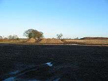
Piles of harvested sugar beet at Swan Farm by Deighton
The name Deighton comes from Old English and means farmstead surrounded by a ditch.[4]
References
- ↑ Ordnance Survey: Landranger map sheet 105 York & Selby (Map). Ordnance Survey. 2014. ISBN 9780319229453.
- ↑ "Ordnance Survey: 1:50,000 Scale Gazetteer" (csv (download)). www.ordnancesurvey.co.uk. Ordnance Survey. 1 January 2016. Retrieved 18 February 2016.
- ↑ "Civil Parish population 2011". Neighbourhood Statistics. Office for National Statistics. Retrieved 18 February 2016.
- ↑ Mills, A.D. (2011) [first published 1991]. A Dictionary of British Place Names (First edition revised 2011 ed.). Oxford: Oxford University Press. p. 148. ISBN 9780199609086.
External links
![]() Media related to Deighton, York at Wikimedia Commons
Media related to Deighton, York at Wikimedia Commons
This article is issued from Wikipedia - version of the 2/19/2016. The text is available under the Creative Commons Attribution/Share Alike but additional terms may apply for the media files.