Denekamp
| Denekamp | ||
|---|---|---|
| Town | ||
|
St. Nicholas Church in Denekamp | ||
| ||
| Nickname(s): Köttelpeern | ||
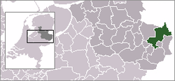 | ||
 The town centre (dark green) and the statistical district (light green) of Denekamp in the municipality of Dinkelland. | ||
| Coordinates: 52°22′46″N 7°0′32″E / 52.37944°N 7.00889°ECoordinates: 52°22′46″N 7°0′32″E / 52.37944°N 7.00889°E | ||
| Country | Netherlands | |
| Province | Overijssel | |
| Municipality | Dinkelland | |
| Population | ||
| • Total | 8,690 | |
| Demonym(s) | Denekampers | |
| Time zone | CET (UTC+1) | |
| • Summer (DST) | CEST (UTC+2) | |


Denekamp is a town in the Dutch province of Overijssel. It is a part of the region of Twente and the municipality of Dinkelland, and lies about 9 km northeast of Oldenzaal.
The town was first noted as early as the 10th century when it was referred to as Daginghem. The location became a municipality in 1818 incorporating the settlements of Noord Deurningen, Lattrop, Breklenkamp, Tilligte, Nutter and Agelo. The municipality merged with Ootmarsum and Weerselo in 2001; the new municipality was first called "Denekamp", but was renamed in 2002 to Dinkelland.[1]
In 2001, the town of Denekamp had 7737 inhabitants. The built-up area of the town was 2.2 km², and contained 2990 residences.[2] The statistical area "Denekamp", which also can include the peripheral parts of the village, as well as the surrounding countryside, has a population of around 8690.[3]
Notable people from Denekamp
- Angerfist, Hardcore techno and Gabber musician and DJ.
- Roméo Dallaire (1946-), Canadian senator and retired general.
- Hennie Kuiper (1949-), world champion cyclist.
- Tanja Nijmeijer, FARC member.
- Radical Redemption, Hardstyle producer and DJ.
References
- ↑ Ad van der Meer and Onno Boonstra, Repertorium van Nederlandse gemeenten, KNAW, 2006.
- ↑ Statistics Netherlands (CBS), Bevolkingskernen in Nederland 2001. (Statistics are for the continuous built-up area).
- ↑ Statistics Netherlands (CBS), Statline: Kerncijfers wijken en buurten 2003-2005. As of 1 January 2005.
External links
- J. Kuyper, Gemeente Atlas van Nederland, 1865-1870, "Denekamp". Map of the former municipality, around 1868.