Dent de Lys
| Dent de Lys | |
|---|---|
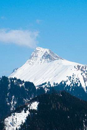 View from Les Pléiades (west side) | |
| Highest point | |
| Elevation | 2,014 m (6,608 ft) |
| Prominence | 502 m (1,647 ft) [1] |
| Coordinates | 46°30′27.5″N 7°0′10.6″E / 46.507639°N 7.002944°ECoordinates: 46°30′27.5″N 7°0′10.6″E / 46.507639°N 7.002944°E |
| Geography | |
 Dent de Lys Location in Switzerland | |
| Location | Fribourg, Switzerland |
| Parent range | Bernese Alps |
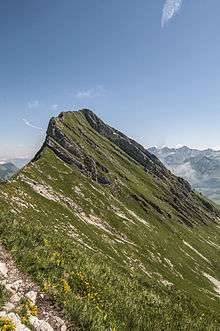
The Dent de Lys (2,014 m) is a mountain in the Bernese Alps (Swiss Prealps), in the canton of Fribourg.
Geography

The Dent de Lys is the natural border of the municipalities of Châtel-St-Denis (west side) and Haut-Intyamon on the east side.
If we follow its south ridge, we can find Folliu Borna (1,849 m, the Vanil des Artses (1,993 m), the Cape au Moine (1,941 m), the Dent de Jaman (1,875 m) and finally les Rochers de Naye (2,042 m).
Climbing
The col de Lys (1,783 m) allows the hikers and skiers to reach the summit of the Dent de Lys from the east and the west.
The last part, on the ridge, can be difficult for those suffering from vertigo. Scrambling ability required. Metal chains have been fixed to the rock to help climbers in some critical sections. Note that in the event of rain the chains become very slippery, increasing difficulty of the descent, in particular. That, and the long period of exposure on the ridge, suggest fine weather for the ascent.
On 25 March 1940, a roped party had an accident near the summit. Three climbers died. The only survivor, a catholic priest, said he was saved by his prayers toward Marguerite Bays (a local girl that eventually became beatified in 1995).[2]
Nowadays, some mortuary crosses can be seen with the name of those who died while tempting the ascent of the summit.
See also
References
- ↑ Retrieved from the Swisstopo topographic maps
- ↑ "Béatification et canonisation, Portail de la liturgie catholique (in French)". Retrieved 10 December 2014.