Devil's Slide (Utah)
For other places with the same name, see Devil's Slide.
Coordinates: 41°03′49″N 111°32′53″W / 41.06361°N 111.54806°W
Front view in Fall of 2008.
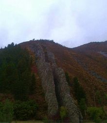
Devil's Slide is an unusual geological formation located in northern Utah's Weber Canyon, near the community of Croydon in Morgan County, Utah, United States. The slide consists of two parallel limestone strata that have been tilted to lie vertical, protruding 40 feet (12 m) out of the mountainside. Intervening layers have eroded more quickly, forming a channel some 25 feet (7.6 m) wide running hundreds of feet down the mountain.[1]
I-84 runs right past Devil's Slide, which can be clearly seen from the road. The Weber River flows between the formation and the freeway. There are parking areas on both sides of the highway for viewing the slide.[2]
Gallery
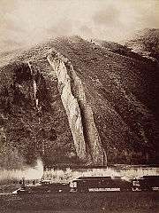 Devil's Slide photo by Carleton Watkins, c.1874
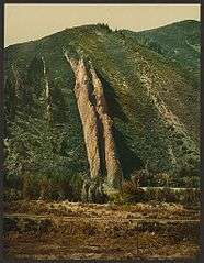 Photochrom print, 1898
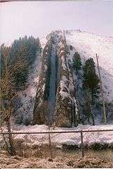 Front view in March 2008 from the south parking area
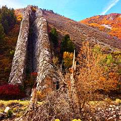 October 2013
References
- ↑ Ege, Carl (April 2003). "Nature's version of a playground slide—Devils Slide, Morgan County, Utah". Survey Notes. Utah Geological Survey. 35 (2): 12. ISSN 1061-7930. Retrieved November 1, 2008.
- ↑ "Landmarks". Morgan County Historical Society. Retrieved March 6, 2008.
External links
| Wikimedia Commons has media related to Devil's Slide (Utah). |
- "The Devil's Slide, Weber Canyon, Utah". California Digital Library, Board of Regents, University of California. Featuring content donated by Bancroft Library. Retrieved March 6, 2008.
This article is issued from Wikipedia - version of the 8/14/2016. The text is available under the Creative Commons Attribution/Share Alike but additional terms may apply for the media files.