Dharmasthali
| Dharmasthali धर्मस्थली | |
|---|---|
| Village development committee | |
 Dharmasthali Location in Nepal | |
| Coordinates: 27°46′N 85°18′E / 27.76°N 85.30°ECoordinates: 27°46′N 85°18′E / 27.76°N 85.30°E | |
| Country |
|
| Zone | Bagmati Zone |
| District | Kathmandu District |
| Population (2011) | |
| • Total | 6,530 |
| Time zone | Nepal Time (UTC+5:45) |
Dharmasthali is a village in Kathmandu District in the Bagmati Zone of central Nepal. At the time of the 2011 Nepal census it had a population of 6,530 and had 1,421 households in it.[1]
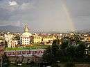
Dharmasthali is popular for its Mahankal temple on the top of a hillock and is only four kilometers from Balaju Ring Road.
Dharmasthali Village Development Committee Consists of 9 wards.Ward No. 9 mainly consists of the natives Basnyats who are believed to migrate from Khaptad, some one and a half century ago, thus called as Khaptadi Basnyats. Major communities are chettri, brahmin and newar.
References
Headquarter: Kathmandu | |||
 |  | ||
This article is issued from Wikipedia - version of the 12/4/2014. The text is available under the Creative Commons Attribution/Share Alike but additional terms may apply for the media files.