Dongola
| Dongola | |
|---|---|
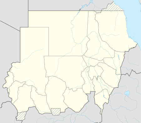 Dongola Location in Sudan | |
| Coordinates: 19°10′11.37″N 30°28′29.62″E / 19.1698250°N 30.4748944°E | |
| Country |
|
| State | Northern |
| Population (2010) | |
| • Total | 13,473 |
Dongola (Arabic: دنقلا Dunqulā), also spelled Dunqulah, and formerly known as Al 'Urdi, is the capital of the state of Northern in Sudan, on the banks of the Nile, and a former Latin Catholic bishopric (14th century). It should not be confused with Old Dongola, an ancient city located 80 km upstream on the opposite bank.
History
Dongola was also a province of Upper Nubia on both sides of the Nile and a centre for Nubian civilization as manifested by its many archaeological remains from the Makurian and Islamic periods. The remains of the revered Baqt Treaty are to be found in Dongola. The province of Dongola was part of the Makuria kingdom, which later became part of Egypt after Muhammad Ali Pasha ordered for the invasion and occupation of Sudan in 1820 after which it was designated as a seat of a pasha. Its first governor was Abidin Bey.
Dongola was the scene of a victory by General Herbert Kitchener over the indigenous Mahdist Muslim tribes in 1896. Dongola Road in the Bishopston area of Bristol was named after this event. So was Dongola Road in Tottenham, North London which runs next to Kitchener Road. There is also a Dongola Road in Jersey (Channel Islands).
Ecclesiastical History
The Latin Catholic Diocese of Dongola was established in 1330 and suppressed in 1350. No incumbent is recorded.
Dongola Racing
The Nile Expedition of 1884–1885 to relieve Gordon at Khartoum passed through the area. Regiments were challenged to race up the river by boat, and this gave rise to the English regatta competition of dongola racing.

Climate
Dongola has a hot desert climate (Köppen climate classification BWh). Dongola is located in one of the hottest, sunniest and driest regions in the world.
| Climate data for Dongola (1961–1990) | |||||||||||||
|---|---|---|---|---|---|---|---|---|---|---|---|---|---|
| Month | Jan | Feb | Mar | Apr | May | Jun | Jul | Aug | Sep | Oct | Nov | Dec | Year |
| Record high °C (°F) | 36.6 (97.9) |
42.2 (108) |
46.0 (114.8) |
46.5 (115.7) |
48.6 (119.5) |
49.1 (120.4) |
49.0 (120.2) |
46.6 (115.9) |
46.8 (116.2) |
44.4 (111.9) |
40.1 (104.2) |
37.3 (99.1) |
49.1 (120.4) |
| Average high °C (°F) | 26.7 (80.1) |
29.4 (84.9) |
33.8 (92.8) |
38.6 (101.5) |
41.8 (107.2) |
43.4 (110.1) |
42.2 (108) |
41.8 (107.2) |
39.8 (103.6) |
38.4 (101.1) |
32.1 (89.8) |
28.3 (82.9) |
36.4 (97.5) |
| Daily mean °C (°F) | 17.6 (63.7) |
19.6 (67.3) |
23.9 (75) |
28.5 (83.3) |
32.1 (89.8) |
34.0 (93.2) |
33.6 (92.5) |
33.5 (92.3) |
32.3 (90.1) |
29.4 (84.9) |
23.5 (74.3) |
19.3 (66.7) |
27.3 (81.1) |
| Average low °C (°F) | 8.5 (47.3) |
9.8 (49.6) |
13.9 (57) |
18.5 (65.3) |
22.3 (72.1) |
24.7 (76.5) |
25.0 (77) |
25.2 (77.4) |
24.7 (76.5) |
20.4 (68.7) |
14.8 (58.6) |
10.2 (50.4) |
18.2 (64.8) |
| Record low °C (°F) | 1.5 (34.7) |
1.0 (33.8) |
4.3 (39.7) |
8.4 (47.1) |
12.6 (54.7) |
17.3 (63.1) |
19.3 (66.7) |
18.0 (64.4) |
16.6 (61.9) |
11.4 (52.5) |
6.0 (42.8) |
2.1 (35.8) |
1.0 (33.8) |
| Average precipitation mm (inches) | 0.3 (0.012) |
0.0 (0) |
0.0 (0) |
0.0 (0) |
0.0 (0) |
0.5 (0.02) |
0.0 (0) |
3.2 (0.126) |
7.7 (0.303) |
0.1 (0.004) |
0.5 (0.02) |
0.0 (0) |
12.3 (0.484) |
| Average precipitation days (≥ 0.1 mm) | 0.1 | 0.0 | 0.1 | 0.0 | 0.1 | 0.0 | 0.5 | 0.9 | 0.1 | 0.2 | 0.0 | 0.0 | 2.0 |
| Average relative humidity (%) | 35 | 30 | 23 | 21 | 18 | 17 | 21 | 22 | 21 | 25 | 32 | 36 | 25 |
| Mean monthly sunshine hours | 306.9 | 294.0 | 319.3 | 321.0 | 325.5 | 339.0 | 334.8 | 337.9 | 288.0 | 319.3 | 315.0 | 313.1 | 3,813.8 |
| Percent possible sunshine | 91 | 91 | 85 | 85 | 84 | 89 | 81 | 83 | 78 | 88 | 93 | 91 | 87 |
| Source: NOAA[1] | |||||||||||||
Education
The town is home to the University of Dongola, a public university.[2]
References
- ↑ "Dongola Climate Normals 1961–1990". National Oceanic and Atmospheric Administration. Retrieved April 23, 2015.
- ↑ "University of Dongala". University of Dongala. Retrieved 2011-09-17.
Sources and External links
| Wikimedia Commons has media related to Dongola. |
- The Shaikiya. An account of the Shaikiya tribes and of the history of Dongola Province from the XIVth to the XIXth century (1913)
- "Dongola, Sudan: Climate, Global Warming, and Daylight Charts and Data". Climatecharts.com. Accessed September 2010.
- GCatholic
Coordinates: 19°10′11.37″N 30°28′29.62″E / 19.1698250°N 30.4748944°E