Drieňok
| Drieňok | |
|---|---|
 | |
| Highest point | |
| Elevation | 1,268 m (4,160 ft) |
| Coordinates | 48°53′25″N 18°57′42″E / 48.89024°N 18.96166°ECoordinates: 48°53′25″N 18°57′42″E / 48.89024°N 18.96166°E |
| Geography | |
 Drieňok Location in Slovakia | |
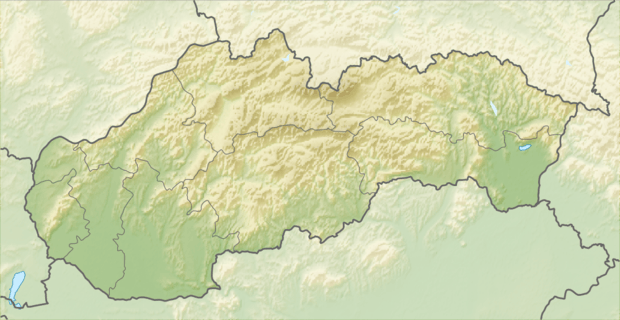
| Location | Turčianske Teplice, Žilina, Slovakia |
| Parent range | Greater Fatra |
| Geology | |
| Mountain type | limestone and dolomite |
Drieňok is a mountain in the Greater Fatra Range of Slovakia measuring 1,268 m (4,160 ft). The typical pyramidal shape of the mountain, which lies on the edge of the range, steeply rises over the Turiec valley and is easily recognizable from any direction. Under the summit there is an emblematic dead and dry tree.
Gallery
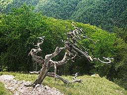
The emblematic dead tree under the summit
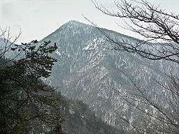
Winter view at Drieňok
References
- Brandos, Otakar (2004). Veľká Fatra, Šípska Fatra. Ostrava: SKY. ISBN 80-86774-02-3.
- VKÚ Harmanec (2003). Veľká Fatra. Edícia turistických máp 1:50000. Harmanec: VKÚ. ISBN 80-8042-044-0.
This article is issued from Wikipedia - version of the 7/18/2016. The text is available under the Creative Commons Attribution/Share Alike but additional terms may apply for the media files.