Dronfield Woodhouse
| Dronfield Woodhouse | |
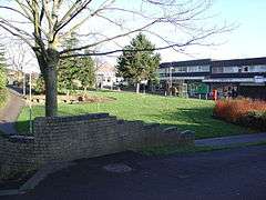 Pentland Road Shops, Gosforth Valley, Dronfield Woodhouse |
|
 Dronfield Woodhouse |
|
| OS grid reference | SK332786 |
|---|---|
| District | North East Derbyshire |
| Shire county | Derbyshire |
| Region | East Midlands |
| Country | England |
| Sovereign state | United Kingdom |
| Post town | DRONFIELD |
| Postcode district | S18 |
| Dialling code | 01246 |
| Police | Derbyshire |
| Fire | Derbyshire |
| Ambulance | East Midlands |
| EU Parliament | East Midlands |
| UK Parliament | North East Derbyshire |
|
|
Coordinates: 53°18′14″N 1°30′11″W / 53.304°N 1.503°W
Dronfield Woodhouse is a district of Dronfield, in North East Derbyshire, England.[1] Its habitation has existed as early as the 11th century (Cowley Farm, to the south) and its main road features a 13th-century house and a 19th-century Primary School (now an elderly care home).
Although Dronfield Woodhouse today constitutes the western half of the town of Dronfield, until the early 1970s it was merely a small collection of houses and farm buildings amidst farmland and woodland. In the 1970s a large housing development was constructed in the adjacent Gosforth Valley, and this resulted in Dronfield Woodhouse becoming a district of Dronfield and a quiet dormitory settlement for nearby Sheffield and Chesterfield. The surrounding countryside is still readily accessible however, and the boundary of the Peak District National Park is less than 2 miles to the west.[1]