Durango Municipality
| Durango | |
|---|---|
| Municipality | |
|
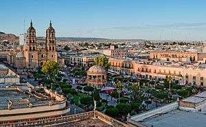
City of Durango | |
|
Durango Location in Mexico | |
| Coordinates: 26°50′0″N 107°8′50″W / 26.83333°N 107.14722°WCoordinates: 26°50′0″N 107°8′50″W / 26.83333°N 107.14722°W | |
| Country |
|
| State | Durango |
| Municipal seat | Durango |
| Area | |
| • Total | 10,041 km2 (3,877 sq mi) |
| Population (2010) | |
| • Total | 582,267 |
| • Density | 58/km2 (150/sq mi) |
Durango is one of the 39 municipalities of Durango, in north-western Mexico. The municipal seat lies at Durango. The municipality covers an area of 10,041 km².
As of 2010, the municipality had a total population of 582,267,[1] up from 526,659 as of 2005.[2]
The municipality had 1,323 localities, the largest of which (with 2010 populations in parentheses) were: Victoria de Durango (518,709), El Nayar (3,308), Cinco de Mayo (2,249), classified as urban, and La Ferrería (Cuatro de Octubre) (2,021), José María Pino Suárez (2,014), Colonia Hidalgo (1,986), Llano Grande (1,938), Sebastián Lerdo de Tejada (1,712), Villa Montemorelos (1,617), Banderas del Águila (1,274), José Refugio Salcido (1,262), Santiago Bayacora (1,218), Cinco de Febrero (1,131), José María Morelos y Pavón (La Tinaja) (1,072), and El Arenal (San Jerónimo) (1,015), classified as rural.[1]
References
- 1 2 "Durango". Catálogo de Localidades. Secretaría de Desarrollo Social (SEDESOL). Retrieved 23 April 2014.
- ↑ "Durango". Enciclopedia de los Municipios de México. Instituto Nacional para el Federalismo y el Desarrollo Municipal. Retrieved November 18, 2008.
