Wilkes Land

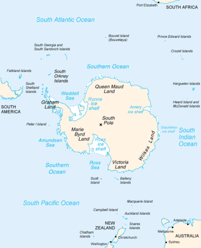
Wilkes Land is a large district of land in eastern Antarctica, formally claimed by Australia as part of the Australian Antarctic Territory, though the validity of this claim has been placed for the period of the operation of the Antarctic Treaty, to which Australia is a signatory. It fronts on the southern Indian Ocean between Queen Mary Coast and Adelie Land, extending from Cape Hordern in 100°31' E to Pourquoi Pas Point, in 136°11' E. The region extends as a sector about 2600 km towards the South Pole, with an estimated land area of 2,600,000 km², mostly glaciated. It is further subdivided in the following coastal areas which can also be thought of as sectors extending to the South Pole:
- Knox Land: 100°31' E to 109°16' E
- Budd Land: 109°16' E to 115°33' E
- Sabrina Land: 115°33' E to 122°05' E
- Banzare Land: 122°05' E to 130°10' E
- Clarie Land: (Wilkes Coast) 130°10' E to 136°11' E
In a wider sense, Wilkes Land extends further East to Point Alden in 142°02' E, thereby including Adelie Land, which is claimed by France.
Name

Wilkes Land is named after Lieutenant Charles Wilkes (later a Rear Admiral), the American explorer who commanded the 1838–42 United States Exploring Expedition. The naming is in recognition of Wilkes' discovery of the continental margin over a distance of 2,400 km (1,500 miles) of coast, thus providing substantial proof that Antarctica is a continent. This definition of extent excludes the area east of 142°02' E, George V Land, which was sighted by Wilkes but has been shown by later expeditions to be further south than the positions originally assigned by him.
Geology

In 2006 a team of researchers led by Ralph von Frese and Laramie Potts used gravity measurements by NASA's GRACE satellites to discover the 300-mile-wide Wilkes Land crater, which probably formed about 250 million years ago.[1]
Wilkes Land in popular culture
- Wilkes Land is featured prominently in the 1998 film The X-Files. Fox Mulder journeys to Antarctica to save his partner Dana Scully, who is being held there against her will. In the process, they discover a huge secret lab under the surface run by the Cigarette-Smoking Man.
See also
References
- ↑ Gorder, Pam Frost (June 1, 2006). "Big Bang in Antarctica — Killer Crater Found Under Ice". Research News.
Coordinates: 69°00′S 120°00′E / 69.000°S 120.000°E