East End Park, Leeds
| East End Park | |
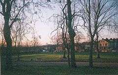 View from East End Park |
|
 East End Park |
|
| Metropolitan borough | City of Leeds |
|---|---|
| Metropolitan county | West Yorkshire |
| Region | Yorkshire and the Humber |
| Country | England |
| Sovereign state | United Kingdom |
| Post town | LEEDS |
| Postcode district | LS9 |
| Dialling code | 0113 |
| Police | West Yorkshire |
| Fire | West Yorkshire |
| Ambulance | Yorkshire |
| EU Parliament | Yorkshire and the Humber |
Coordinates: 53°47′39″N 1°31′32″W / 53.7943°N 1.5256°W
East End Park is an inner city area of east Leeds, West Yorkshire, England. It is situated between Burmantofts to the north west, Harehills to the north east (although not a direct neighbour), Halton Moor to the east, Richmond Hill to the west and Cross Green to the south west. It blends into the Halton Moor/Osmondthorpe area and is 1 mile to the east of Leeds city centre in the LS9 Leeds postcode area.
The area is situated in the vicinity of the A64 York Road, east Leeds' main thoroughfare, and is also home to a large park dating back from Victorian times which was purchased by Leeds City Council in the late 19th century, when it was waste land. Housing in the area is made up of nineteenth-century through terraced housing, some back-to-back terraced housing. Semi-detached and detached houses are also found in the area. Many of the back-to-back terraced houses in the area were due to be demolished as part of the £1.3 billion EASEL regeneration scheme in east and south east Leeds. However these plans were withdrawn in 2010 with Leeds City Council citing the recession debilitating the private sector's ability to build as the main reason.[1][2][3][4]
Crime is unevenly distributed across East End Park. The Glensdales, Templeviews and Charltons are a small cluster of predominately back-to-back streets noted for the majority of the area's crime and have subsequently become a priority area of West Yorkshire Police, crime in the rest of the estate is much less common. The same group of streets are a focus of some regeneration in the area.[5]
The area is home to one of the major Irish communities in Leeds, and is home to the prestigious music venue 'The Irish Centre', the first purpose built Irish Centre in Britain. The centre opened on 20 January 1970, although the official opening ceremony was held on 8 June 1970.[6]
The Park
East End Park is a Victorian Park managed by Parks and Countryside, part of the Learning and Leisure Department, Leeds City Council. The park offers a diverse range of sporting and leisure facilities for all age ranges, including; bowling greens, tennis courts, football pitches and a basketball court. The playground and teen shelter have been recently installed and are proving very popular.
There are plenty of open spaces in the park and areas of well established woodland create help create a diverse and interesting habitat. There are also seating areas amongst rose and shrub beds.
The Friends of East End Park are a newly established community group who contribute to the development and improvement of the park.[7] They also assist in the organisation of three brass band concerts each year which are funded by the local councillors, and for the past two years have held a Fun Day for the local children during the summer holidays. It is hoped, along with the band concerts, to make this an annual event. With the help of the Parks Department, and councillors, the local schools have assisted in planting spring flowering bulbs, which again has been organised by The Friends
East End Park hosts many events throughout the year including an annual bonfire and fun fair which attracts up to 10,000 visitors. A tennis camp is held each August for young people.[8]
In March 2009, Trees for Cities and Leeds City Council planted 3,000 whips at East End Park in order to create new areas of urban woodland to help screen the park from the railway line that runs behind it. The planting follows planting in 2007 when, with the help of the local community, 18 large trees were planted to replace those lost in September 2006 when a freak tornado struck the city.[9][10][11]
Transport
East End Park is situated in the vicinity of the A64 York Road, east Leeds' main thoroughfare, providing the area with a well established and reliable bus service. Most bus routes are operated by First Leeds and Arriva Yorkshire. The 19 and 19A run to Garforth, Colton, Halton, the city centre, Headingley, West Park, Ireland Wood and Tinshill. The 5 runs to Halton Moor, Osmondthorpe and the city centre. The 40 and 40A run to Whinmoor, Swarcliffe, Cross Gates, Halton and the city centre. The 56 runs to Whinmoor, Seacroft, Killingbeck, Hyde Park, the University of Leeds, Headingley and Moor Grange. The 163 and 166 run from the city centre to Castleford, as well as services that run along the A64 to the east coast. The closest railway station is Leeds railway station.
Location grid
 |
Burmantofts | | ||
| Richmond Hill | |
Cross Green | ||
| ||||
| | ||||
| Halton |
References
- ↑ http://www.leeds.gov.uk/Page.aspx?pageIdentifier=1b91a511-8ef2-4749-9aef-c1cee7017b77
- ↑ http://www.leedsinitiative.org/construction/page.aspx?id=10148&terms=east+leeds
- ↑ http://www.leeds.gov.uk/files/Internet2007/2007/week24/inter__13710bc4-26b7-47af-a786-58fd29403643_d6d13b13-1f93-438f-8936-3ec758b616f3.pdf
- ↑ http://www.leeds.gov.uk/council/Pages/EASEL-Area-Action-Plan.aspx
- ↑ http://www.leeds.gov.uk/files/Internet2007/2007/week24/inter__13710bc4-26b7-47af-a786-58fd29403643_d6d13b13-1f93-438f-8936-3ec758b616f3.pdf
- ↑ http://www.theleedsirishcentre.co.uk/Aboutus.htm
- ↑ http://friendsofeastendpark.blogspot.com/
- ↑ http://www.leeds.gov.uk/About_Leeds/Places_to_visit/Parks_and_gardens/East_End_Park.aspx
- ↑ http://www.treesforcities.org/page.php?id=274
- ↑ http://www.bbc.co.uk/leeds/content/articles/2006/09/14/weather_storms_20060914_feature.shtml
- ↑ http://www.yorkshireeveningpost.co.uk/news/Terror-storm-hits-Leeds.1771652.jp