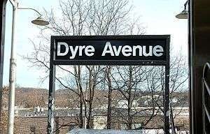
Eastchester–Dyre Avenue (IRT Dyre Avenue Line)
| Eastchester–Dyre Avenue | |||||||
|---|---|---|---|---|---|---|---|
| New York City Subway rapid transit station | |||||||
 | |||||||
| Station statistics | |||||||
| Address |
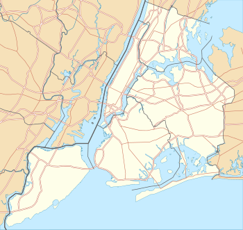
Dyre Avenue & East 233rd Street Bronx, NY 10466 | ||||||
| Borough | The Bronx | ||||||
| Locale | Eastchester | ||||||
| Coordinates | 40°53′21″N 73°49′50″W / 40.889055°N 73.830614°WCoordinates: 40°53′21″N 73°49′50″W / 40.889055°N 73.830614°W | ||||||
| Division | A (IRT, formerly NYW&B) | ||||||
| Line | IRT Dyre Avenue Line | ||||||
| Services |
5 | ||||||
| Transit connections |
| ||||||
| Structure | Embankment / Elevated | ||||||
| Platforms | 1 Island platform | ||||||
| Tracks | 2 | ||||||
| Other information | |||||||
| Opened | May 29, 1912 (NYW&B station) | ||||||
| Rebuilt | May 15, 1941 (as a Subway station) | ||||||
| Traffic | |||||||
| Passengers (2015) |
1,330,123[1] | ||||||
| Rank | 323 out of 422 | ||||||
| Station succession | |||||||
| Next north |
(Terminal): 5 | ||||||
| Next south |
Baychester Avenue: 5 | ||||||
| |||||||
| |||||||


Eastchester–Dyre Avenue (signed as simply Dyre Avenue) is the northern terminal station of the IRT Dyre Avenue Line of the New York City Subway, at Dyre Avenue and East 233rd Street in the Bronx neighborhood of Eastchester. It is served by the 5 train at all times.
Station layout
| P Platform level |
Southbound | Bowling Green weekends, East 180th Street late nights (Baychester Avenue) → |
| Island platform, doors will open on the left or right | ||
| Southbound | Bowling Green weekends, East 180th Street late nights (Baychester Avenue) → | |
| M | Mezzanine | Fare control, station agent |
| G | Street Level | Exit/Entrance |
Opened on May 29, 1912 as a local station of the New York, Westchester and Boston Railway, it closed on December 12, 1937 when the NYW&B went bankrupt. In 1940, New York City purchased the right of way from the Bronx / Westchester County boundary southward. In 1941, a shuttle service was implemented between Dyre Avenue and East 180th Street using IRT gate cars. In 1957, a physical connection was made to the IRT White Plains Road Line, and through service was provided.
When the station was rebuilt for subway service the two side platforms were removed, with a small piece of the northbound remaining. The four tracks were converted to two tracks using the northbound local and southbound express tracks. An island platform was placed over the northbound express trackbed. The NYW&B's southbound local trackbed can still be seen, and is currently used only for an electrical shed on the north end of the bridge, as well as girders holding up two construction trailers used by MTA crew members over the south end of the bridge. The two tracks extend one train length past the station, and end at bumper blocks.
The northern end of the station is on an embankment, while the southern end is elevated. The station's only station house is on ground level with doors to the east side of Dyre Avenue on the northeast corner of Light Street. It has a token booth, turnstile bank, and two staircases to the platform. The city of Mount Vernon in Westchester County is 0.3 miles (0.48 km) uphill.
References
- ↑ "Facts and Figures: Annual Subway Ridership". Metropolitan Transportation Authority. Retrieved 2016-04-19.
External links
| Wikimedia Commons has media related to Eastchester – Dyre Avenue (IRT Dyre Avenue Line). |
- nycsubway.org – IRT White Plains Road Line: Dyre Avenue
- Station Reporter — 5 Train
- The Subway Nut — Eastchester–Dyre Avenue Pictures
- Dyre Avenue entrance from Google Maps Street View