Eatontown Public Schools
| Eatontown Public Schools | ||||||||||||||||||||||||||||||||||||||||||||||||||||||||||||
|---|---|---|---|---|---|---|---|---|---|---|---|---|---|---|---|---|---|---|---|---|---|---|---|---|---|---|---|---|---|---|---|---|---|---|---|---|---|---|---|---|---|---|---|---|---|---|---|---|---|---|---|---|---|---|---|---|---|---|---|---|
|
5 Grant Avenue Eatontown, NJ 07724 | ||||||||||||||||||||||||||||||||||||||||||||||||||||||||||||
| District information | ||||||||||||||||||||||||||||||||||||||||||||||||||||||||||||
| Grades | PreK-8 | |||||||||||||||||||||||||||||||||||||||||||||||||||||||||||
| Superintendent | Scott T. McCue | |||||||||||||||||||||||||||||||||||||||||||||||||||||||||||
| Business administrator | Lori Youngclaus | |||||||||||||||||||||||||||||||||||||||||||||||||||||||||||
| Schools | 4 | |||||||||||||||||||||||||||||||||||||||||||||||||||||||||||
| Students and staff | ||||||||||||||||||||||||||||||||||||||||||||||||||||||||||||
| Enrollment | 1,062 (as of 2011-12)[1] | |||||||||||||||||||||||||||||||||||||||||||||||||||||||||||
| Faculty | 102.0 FTEs[1] | |||||||||||||||||||||||||||||||||||||||||||||||||||||||||||
| Student-teacher ratio | 10.4:1[1] | |||||||||||||||||||||||||||||||||||||||||||||||||||||||||||
| Other information | ||||||||||||||||||||||||||||||||||||||||||||||||||||||||||||
| District Factor Group | FG | |||||||||||||||||||||||||||||||||||||||||||||||||||||||||||
| Website | http://www.eatontown.org | |||||||||||||||||||||||||||||||||||||||||||||||||||||||||||
| ||||||||||||||||||||||||||||||||||||||||||||||||||||||||||||
The Eatontown Public Schools is a community public school district that serves students in pre-kindergarten through eighth grade from Eatontown in Monmouth County, New Jersey, United States.
As of the 2013-14 school year, the district's four schools had an enrollment of 1,062 students and 102.0 classroom teachers (on an FTE basis), for a student–teacher ratio of 10.4:1.[1]
The district is classified by the New Jersey Department of Education as being in District Factor Group "FG", the fourth-highest of eight groupings. District Factor Groups organize districts statewide to allow comparison by common socioeconomic characteristics of the local districts. From lowest socioeconomic status to highest, the categories are A, B, CD, DE, FG, GH, I and J.[3]
Public school students in ninth through twelfth grades attend Monmouth Regional High School, located in Tinton Falls. The high school is part of the Monmouth Regional High School District, which serves students from Shrewsbury Township and Tinton Falls, along with students from Eatontown and Naval Weapons Station Earle.[4] As of the 2011-12 school year, the school served 1,008 students.[5]
Schools
Schools in the district (with 2013-14 enrollment data from the National Center for Education Statistics[6]) are:[7]
- Elementary schools
- Meadowbrook Elementary School[8] (grades K-6; 286 students - changed to K-2)
- Valerie Cioffi, Principal
- Margaret L. Vetter Elementary School[9] (PreK-6; 280 - changed to 5-6)
- Kevin Iozzi, Principal
- Woodmere Elementary School[10] (K-6; 255 - changed to PreK and 3-4)
- Kristoffer Brogna, Principal
- Middle school
- Memorial Middle School[11] for grades 7 and 8 (241)
- Jay Medlin, Principal
Administration
Core members of the district's administration are:[12][13]
- Scott T. McCue, Superintendent of Schools
- Lori Youngclaus, School Business Administrator / Board Secretary
References
- 1 2 3 4 District information for Eatontown School District, National Center for Education Statistics. Accessed November 19, 2016.
- ↑ Taxpayers' Guide to Education Spending April 2013, New Jersey Department of Education. Accessed April 15, 2013.
- ↑ NJ Department of Education District Factor Groups (DFG) for School Districts, New Jersey Department of Education. Accessed January 12, 2015.
- ↑ Monmouth Regional High School 2013 Report Card Narrative, New Jersey Department of Education. Accessed March 19, 2015. "Monmouth Regional is a comprehensive high school serving a culturally diverse student population of approximately 1050 students. Pupils attending reside in the Monmouth County communities of Eatontown, Shrewsbury Township, and Tinton Falls. In addition, some students come from the military facility of Earle Naval Weapons Station."
- ↑ Data for Monmouth Regional High School, National Center for Education Statistics. Accessed January 12, 2015.
- ↑ Data for Eatontown Public Schools, National Center for Education Statistics. Accessed January 12, 2015.
- ↑ New Jersey School Directory for the Eatontown Public Schools, New Jersey Department of Education. Accessed January 12, 2015.
- ↑ Meadowbrook Elementary School, Eatontown Public Schools. Accessed January 12, 2015.
- ↑ Margaret L. Vetter Elementary School, Eatontown Public Schools. Accessed January 12, 2015.
- ↑ Woodmere Elementary School, Eatontown Public Schools. Accessed January 12, 2015.
- ↑ Memorial Middle School, Eatontown Public Schools. Accessed January 12, 2015.
- ↑ Board of Education, Eatontown Public Schools. Accessed January 12, 2015.
- ↑ New Jersey School Directory for Monmouth County, New Jersey Department of Education. Accessed January 12, 2015.
External links
- Eatontown Public Schools
- Eatontown Public Schools's 2014–15 School Report Card from the New Jersey Department of Education
- Data for Eatontown Public Schools, National Center for Education Statistics
- Monmouth Regional High School District
Coordinates: 40°18′23″N 74°03′01″W / 40.306304°N 74.05034°W
| K-6 | 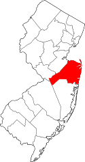 | |
|---|---|---|
| K-8 |
| |
| K-12 | ||
| 7-12 | ||
| 9-12 | ||
| None |
| |
| ||