Eferi
| Eferi | |
|---|---|
| Village | |
 Eferi | |
| Coordinates: DZ 24°28′36″N 9°30′47″E / 24.47667°N 9.51306°ECoordinates: DZ 24°28′36″N 9°30′47″E / 24.47667°N 9.51306°E | |
| Country |
|
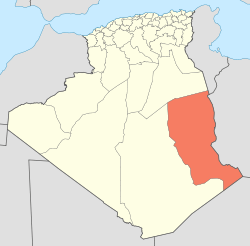
| Province | Illizi Province |
| District | Djanet District |
| Commune | Djanet[1] |
| Elevation | 1,027 m (3,369 ft) |
| Time zone | CET (UTC+1) |
Eferi is a village in the commune of Djanet,[1] in Djanet District, Illizi Province, Algeria. Along with the other localities near Djanet it lies at the south-western edge of the Tassili n'Ajjer mountain range.[2]
References
- 1 2 "Décret n° 84-365, fixant la composition, la consistance et les limites territoriale des communes. Wilaya d'El Oued" (PDF) (in French). Journal officiel de la République Algérienne,. 19 December 1984. p. 1554. Archived from the original (PDF) on 2 March 2013 or before. Retrieved 2 March 2013. Check date values in:
|archive-date=(help) - ↑ "Eferi, Algeria". Google Maps. Retrieved 24 May 2013.
Neighbouring towns and cities
 |
Bordj El Houasse | Illizi Djanet Adjahil |
Ghat (Libya) | |
| Tazrouk (Tamanrasset) Tamanrasset |
|
Tin El Koum | ||
| ||||
| | ||||
| In Guezzam (Tamanrasset) | Iferouane (Niger) | Djanet |
This article is issued from Wikipedia - version of the 2/9/2016. The text is available under the Creative Commons Attribution/Share Alike but additional terms may apply for the media files.