El Fasher Airport
| El Fashir Airport | |||||||||||||||
|---|---|---|---|---|---|---|---|---|---|---|---|---|---|---|---|
| IATA: ELF – ICAO: HSFS | |||||||||||||||
| Summary | |||||||||||||||
| Airport type | Public | ||||||||||||||
| Operator | Government | ||||||||||||||
| Serves | El Fasher, Sudan | ||||||||||||||
| Elevation AMSL | 2,393 ft / 729 m | ||||||||||||||
| Coordinates | 13°36′53″N 025°19′28″E / 13.61472°N 25.32444°ECoordinates: 13°36′53″N 025°19′28″E / 13.61472°N 25.32444°E | ||||||||||||||
| Map | |||||||||||||||
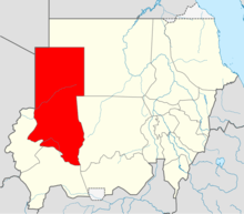 HSFS Location in Sudan (North Darfur state highlighted) | |||||||||||||||
| Runways | |||||||||||||||
| |||||||||||||||
El Fasher Airport (IATA: ELF, ICAO: HSFS), also known as Al Fashir Airport, is an airport serving El Fasher[1] (Al Fashir), the capital city of the North Darfur state in Sudan.
Facilities
The airport resides at an elevation of 2,393 feet (729 m) above mean sea level. It has 2 runways: 05/23 with an asphalt surface measuring 2,970 by 45 metres (9,744 ft × 148 ft) and 18/36 with a gravel surface measuring 1,527 by 45 metres (5,010 ft × 148 ft).[1]
Airlines and destinations
| Airlines | Destinations |
|---|---|
| Badr Airlines | Khartoum[3] |
| Nova Airways | Khartoum, Nyala [4] |
| Sudan Airways | Khartoum |
References
- 1 2 3 Airport information for HSFS from DAFIF (effective October 2006)
- ↑ Airport information for ELF at Great Circle Mapper. Source: DAFIF (effective October 2006).
- ↑ January 2014 Timetable,http://www.badrairlines.com/index.php?option=com_wrapper&view=wrapper&Itemid=16
- ↑ Nova Airways Schedule
External links
This article is issued from Wikipedia - version of the 12/4/2016. The text is available under the Creative Commons Attribution/Share Alike but additional terms may apply for the media files.